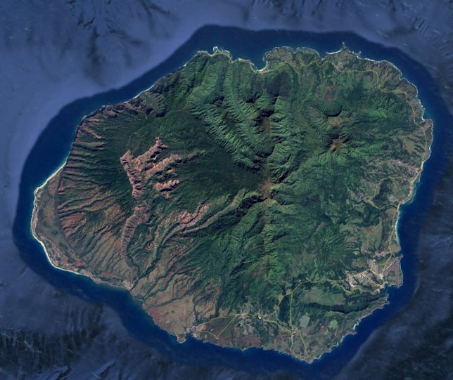
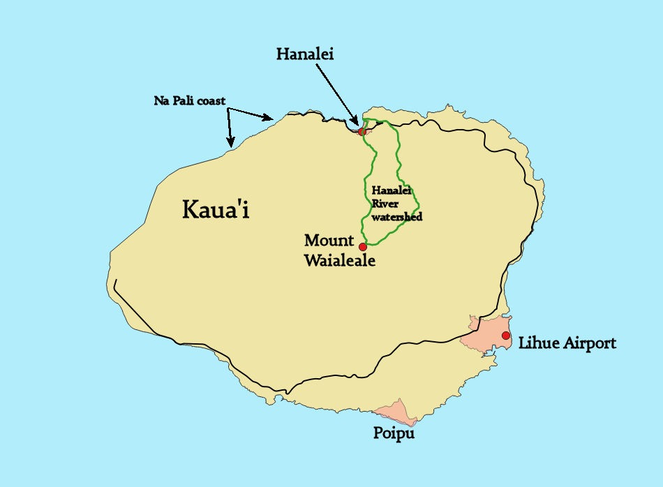
Among the oldest of the Hawaiian Islands is Kaua’i to the northwest of the Pacific island chain. Mount Waialeale (why-allay-allay), at 5148 feet elevation, has been known to be the wettest place on Earth. Called the Garden Isle, Kaua’i holds some of the most lush and diverse ecosystems in all of Hawaii. It has eroded to very steep ridgelines that yet remain covered with vegetation. The Big Island, by contrast, is the youngest in the chain, with a still active volcano and many acres of bare, hardened lava.
Here’s a view of Kaua’i, using Google Earth:
In 2005, I was involved in a study of the Hanalei River watershed on the north side of the island. The main issue of concern was that runoff from the river was causing serious water quality issues in Hanalei Bay and degrading its coral reefs. Could we scientists and engineers have a look at the watershed and determine the cause?
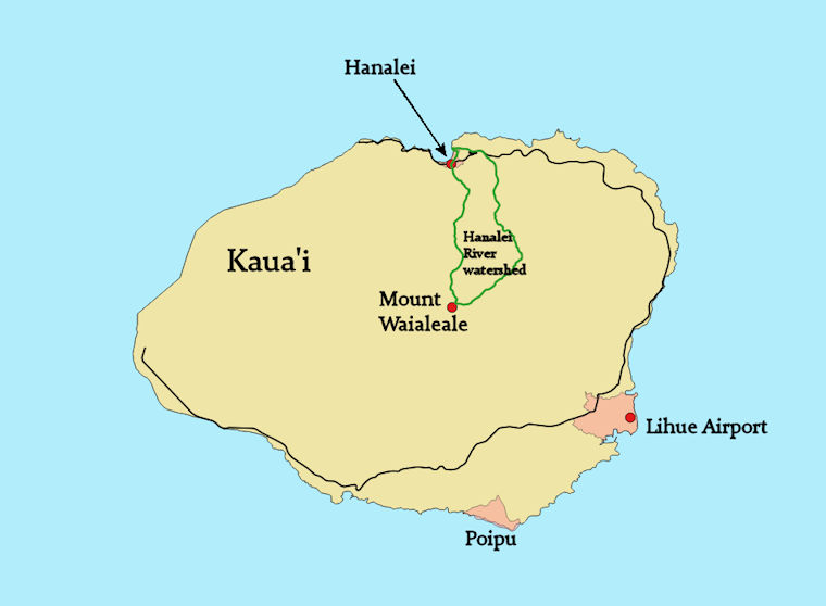
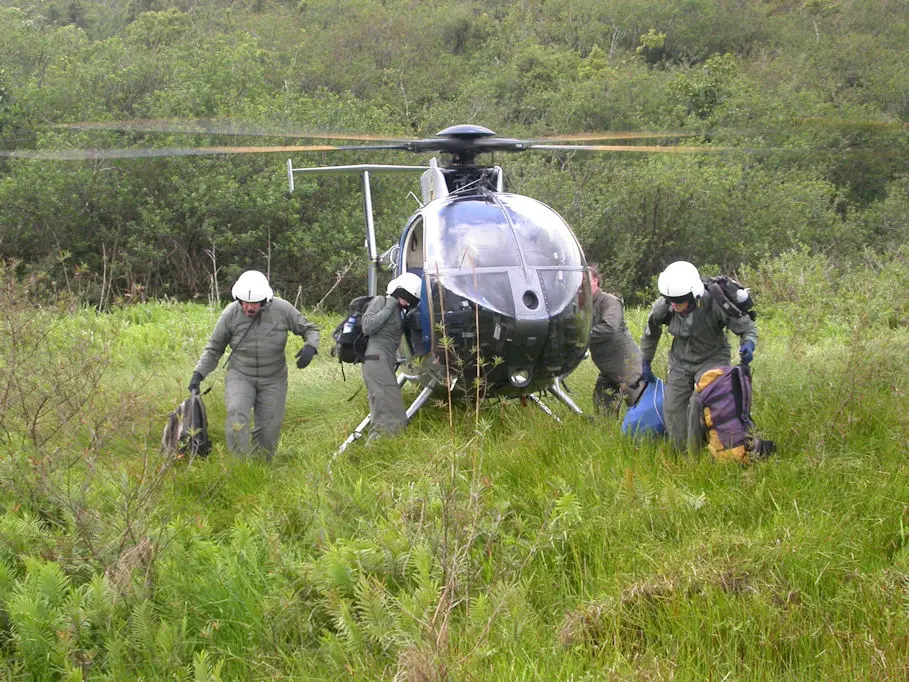
An interdisciplinary team gathered to investigate. The only road in the watershed, from Hanalei town southward, came to a dead end well short of the main basin area. We would need to fly in by helicopter and be dropped off for a closer look at the stream, the steep ridge slopes, and any areas experiencing landslides.
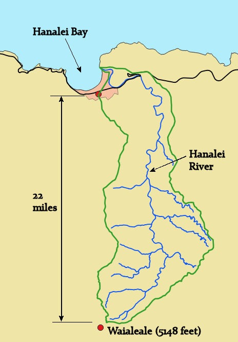
Zooming in, you can see that the Hanalei watershed must transport the extensive rainfall from elevations over 5000 feet to sea level in roughly 25 miles of river channel. Streams of such a steep gradient allow gravity to transport not only plenty of silt and sand, but also large cobbles.
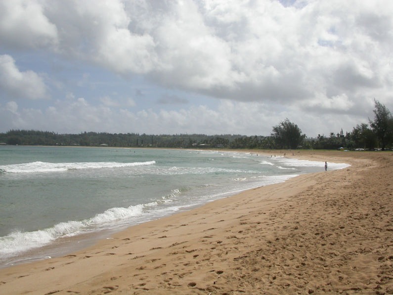
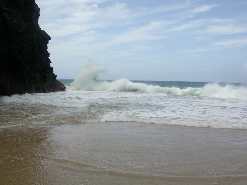
First, let’s have a look at the Hanalei Bay shoreline and some underwater shots of coral with problems.
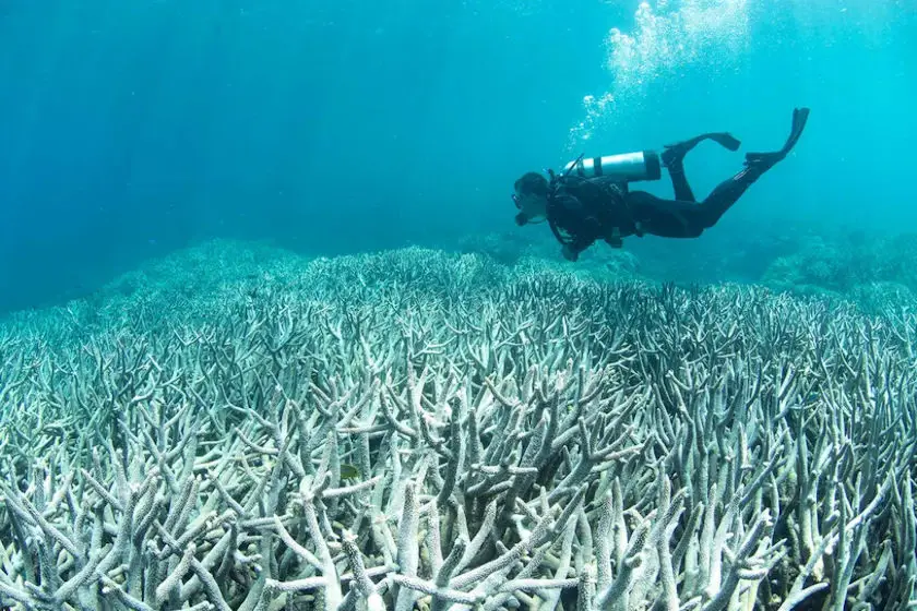
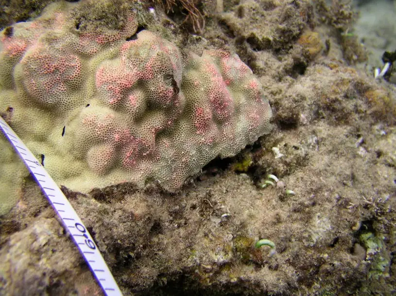
The bleached coral photo on the left is from an article in Smithsonian Magazine, titled, “The Planet has Lost Half of Its Coral Reefs Since 1950.” On the right, the photo of stressed coral is from Eyes of the Reef Hawai’i, specifically, a section on biological interactions with coral.
One of the dominant hypotheses at the time of what was causing problems on the reef was the influx of silt from the watershed. This silt would settle on the coral and block its access to vital sunlight. If this silt layer was not too thick, the coral could actually poke through it or even grow through it and regain sunlight access. But continual tidal and storm surge currents would daily stir up and resettle the silt.
Check out the EPA page about Hanalei Bay from this link: click to new tab.
Note that the current administration seems to have begrudgingly allowed this page to remain accessible, though it is archived from 2017. The highlighted water quality issues for Hanalei Bay include turbidity due to silt and the biological issue of “Enterococci.” The Wikipedia article has a paragraph on water quality that specifically cites issues in Hawaii, specifically for dangers to humans at the beaches. But coral also suffers!
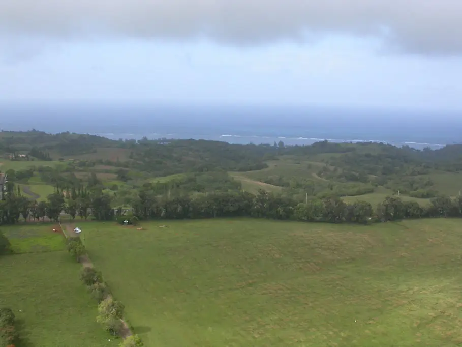
Our investigation sought to determine the causes of turbidity due to silt in the river water. The small helicopter that ferried us had no doors, which was convenient for taking photos. Shortly after takeoff, looking toward the bay:
One serious water quality issue may be connected to the traditional Hawaiian agricultural practice of growing taro:
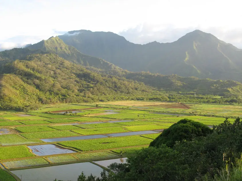
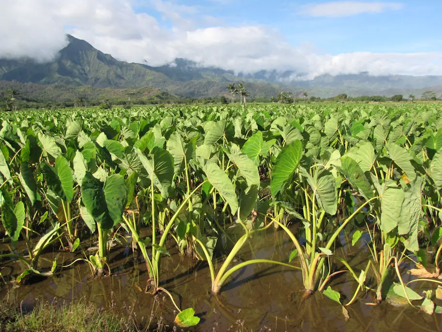
These photos are from Wikipedia. (attribution left Bealbrown at Wikipedia, and right by Forrest and Kim Starr)
Similar to growing rice, taro fields are flooded during the cultivation process. At some point, the fields are quickly drained, and sediment-laden water, dumped into the Hanalei River, proceeds directly to the bay. One caveat: our study only identified possible causes of water turbidity, not quantifying any extent of blame to a particular cause. Some other possible causes are shown below.
Continuing the helicopter flight, here’s a view of the more downstream end of the river:
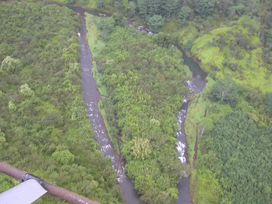
Moving upstream:
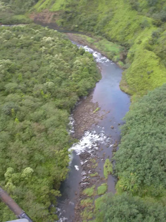
Getting a closer look: (notice the small mirror for the pilot):
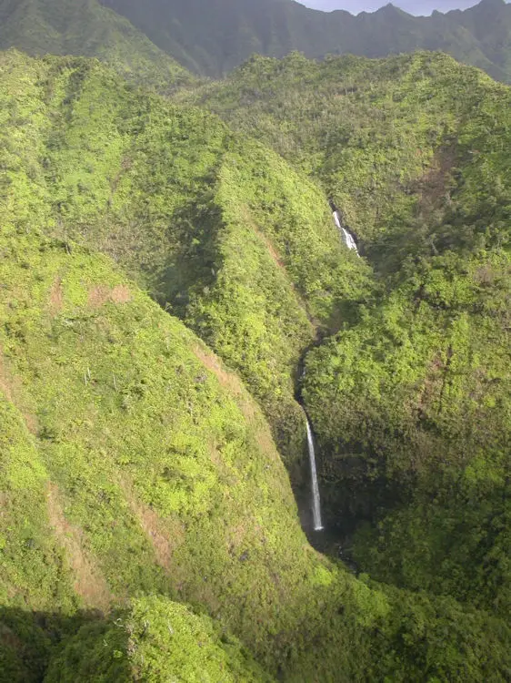
Toward the upstream end, looking at rising vertical slopes:
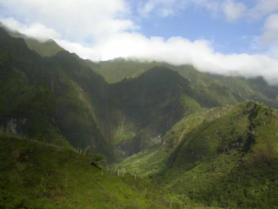
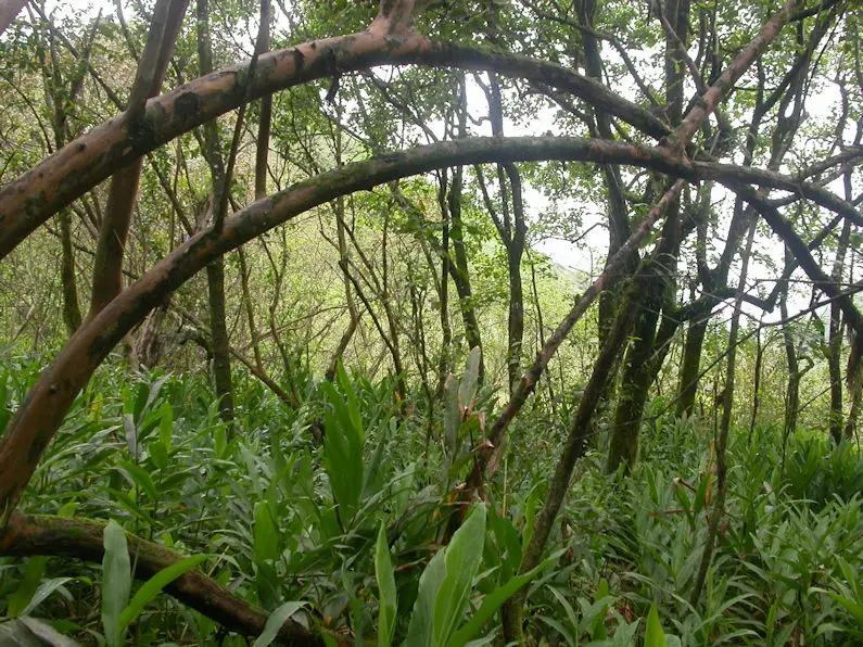
All along the steep slopes, the Hanalei contributing streams become sequences of waterfalls:
We needed to get on the ground for a closer look at any possible erosion issues:
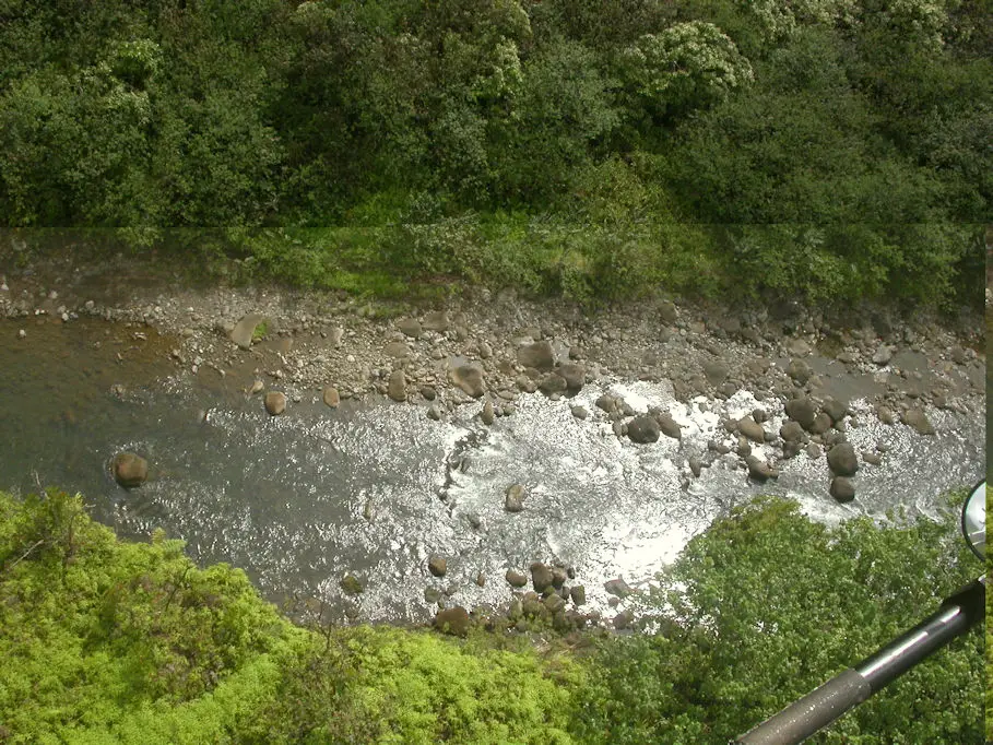
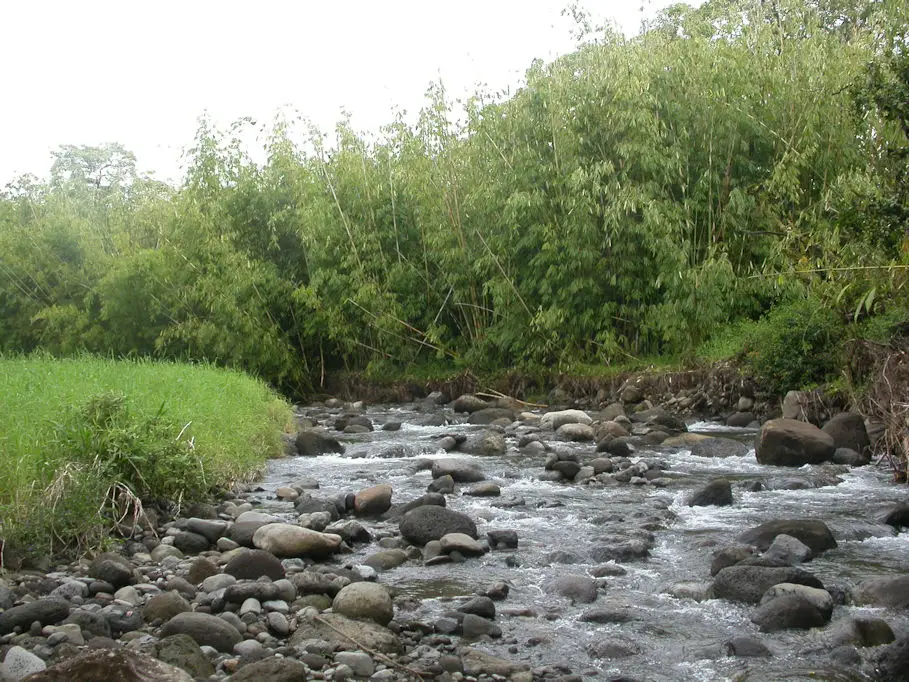
The stream does not seem steep in this photo, but all the cobbles and boulders reveal that when it gets flowing, the water has plenty of erosional power:
All along the steep side slopes of the watershed, we could see numerous small vertical scars where the cliffs broke off an outer layer and dropped a silt and clay-laden pile at their bases. (Geologists call this a talus pile.)
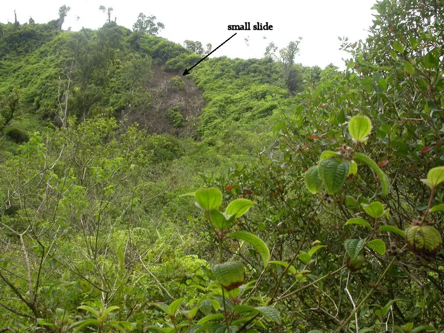
We climbed up to one of these for a closer look. These slides are like shedding skin and are caused by gravity working on the rain-soaked vegetation:
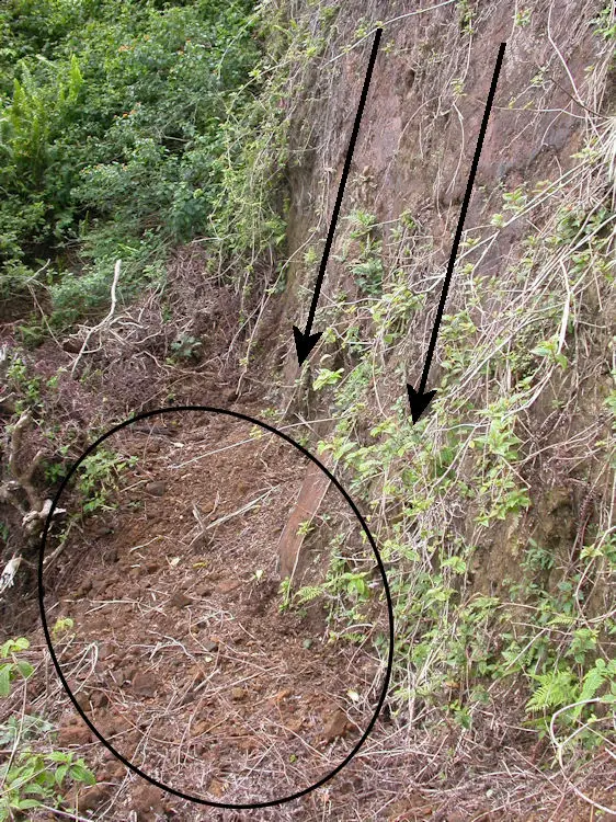
Vegetation will quickly grow again on the talus pile and begin to stabilize the soil. But plenty will run off with the side streams and into the Hanalei main channel. (But does the accumulation of all these minor slides contribute much to the problem in the bay?)
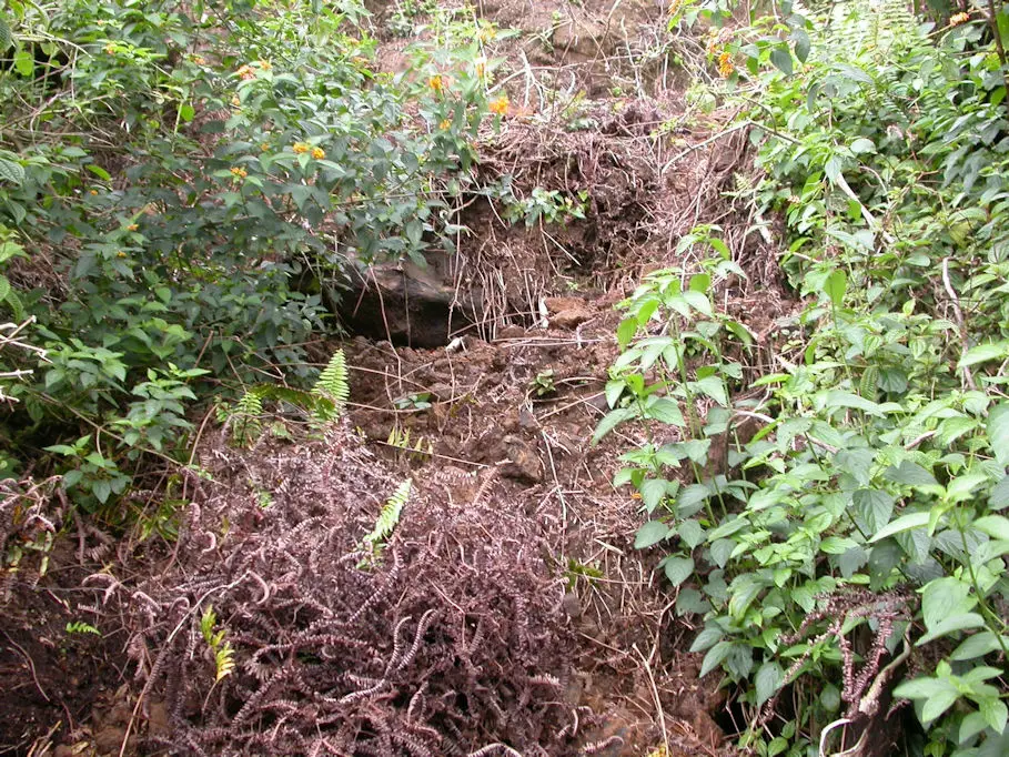
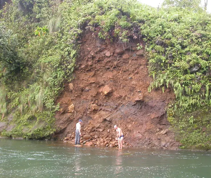
The stream itself causes another issue:
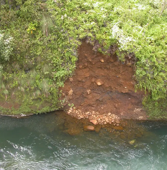
The above photo was taken from the helicopter. This talus pile will not stabilize, but will completely wash downstream over time. While on the ground, we got a closer look, which gives you a sense of the scale (neither of those guys is me):
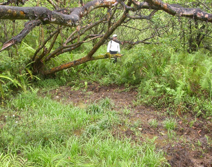
If these two natural processes comprise the bulk of the problems in Hanalei Bay, we have no realistic solution to mitigate the sediment load. We tromped through the jungle to investigate another suspected issue.
Kauai has feral pigs. Check out this web page: (click to new tab)

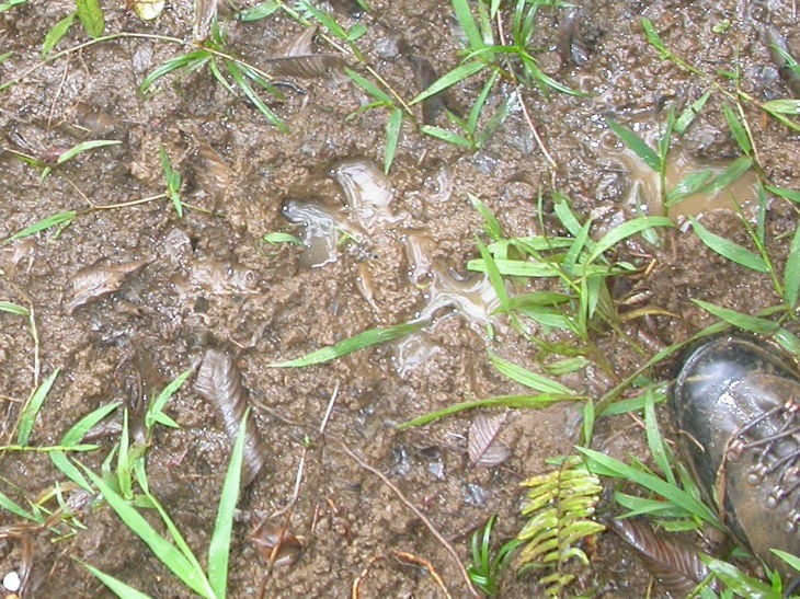
These have been on Kaua’I since the time of the Polynesians. Local hunters enjoy going after them, so they tend not to favor an eradication program. The pigs cause sediment problems by just running around doing their thing. For example, below is a muddy mess below one of their favorite hangouts, a mango tree:
How do we know this was caused by feral pigs? Look closer:
These critters also like to use the small feeder side streams as easy ways to get around. We found evidence of erosion in these waterways by pigs either climbing out of the stream or reaching up on their hind legs to browse on overhanging vegetation.
Our study concluded that these issues contribute to the turbidity problems at the reef:
- upland side slope sloughing
- stream side erosion scars
- feral pig foraging
- taro farming practices
Insufficiently functioning residential septic tanks and drain fields also possibly contribute to biological water quality problems. The bottom line for Hanalei Bay is that the issues are multifaceted and would require significant public funds and local support to make a dent.
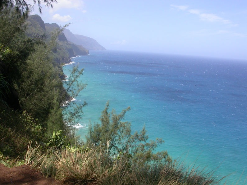
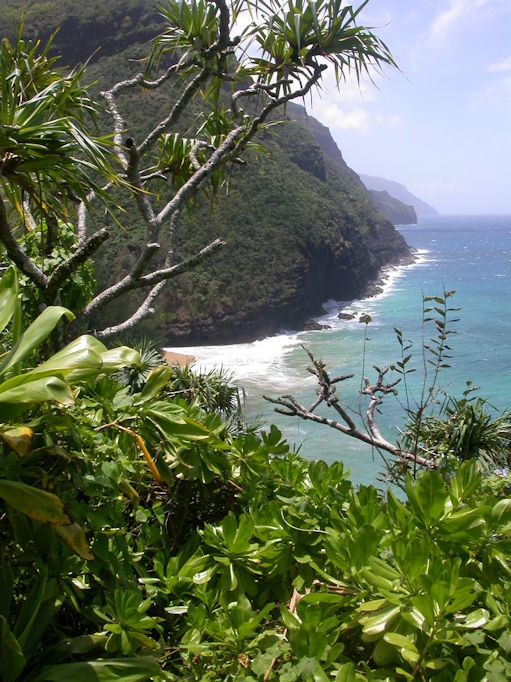
Before leaving, I enjoyed a hike along the famous Na Pali coast. On the map, the state park is at the end of the road west of Hanalei:
Views from the coastal trail:
The title of this blog post refers to numerous projects around the ocean coastlines that seek holistic approaches for managing coastal human activities so as to minimize harm in their near-shore ecosystems. If you are interested in checking out a few of these efforts:
These photos bring great memories. I’ve always enjoyed hearing about your professional work. I know you’ve enjoyed all of your ventures in the field. Thanks for including the links. Thank you for caring for the environment!
-diane
I always found your work fascinating Dan when I had a chance to hear about it. Thanks for going back and explaining what you did in Hawaii.
Thanks, Bryan! I was very lucky in my career to get out and experience so much of our beautiful planet.