Since I enjoy driving, I didn’t expect this long journey to cause any problems. It didn’t. The adventure was worth it. As usual with my travels, I knew that the trip would only whet my appetite to return for the many experiences we did not have time to investigate. We drove my 2019 Honda Accord, a four-cylinder with a manual transmission, which gets about 35 miles per gallon.
This travelogue will show with maps, photos, and videos, what we did each day for fifteen total. My traveling companion was Paul Pedone, a retired geologist from the same office as me, the USDA Natural Resources Conservation Service in Portland, Oregon. Since my wife Diane still works, she did not join us for the drive, but we picked her up at the airport in Anchorage and dropped her off in Fairbanks. One could say our ultimate goal was a peak experience, such as the following view of Mount Denali, 20,308 feet high:
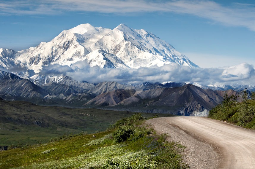
This 2012 photo, courtesy of the National Park Service, shows the mountain in its full majesty, which few visitors are fortunate enough to see. Denali is frequently shrouded by passing clouds, which often obscure views of the peak. What’s more, visitors cannot currently travel to the end of the one park road because a landslide destroyed the road at about the halfway point. (More on that later.)
People sometimes refer to Australia as the land down under. Anyone with a globe can see why. Heading toward the opposite pole, Paul and I were going to the land up and over. Stretch a string taut on a globe, and you will trace out a great circle segment, the shortest distance between two points on the curving earth’s surface. That taut string between Portland, Oregon (our starting point) and Anchorage, Alaska, is the same as between Portland and St. Louis, Missouri. By road, the distance to Anchorage is 2450 miles. That same road distance toward St. Louis overshoots it by 400 miles, taking you further to Columbus, Ohio.
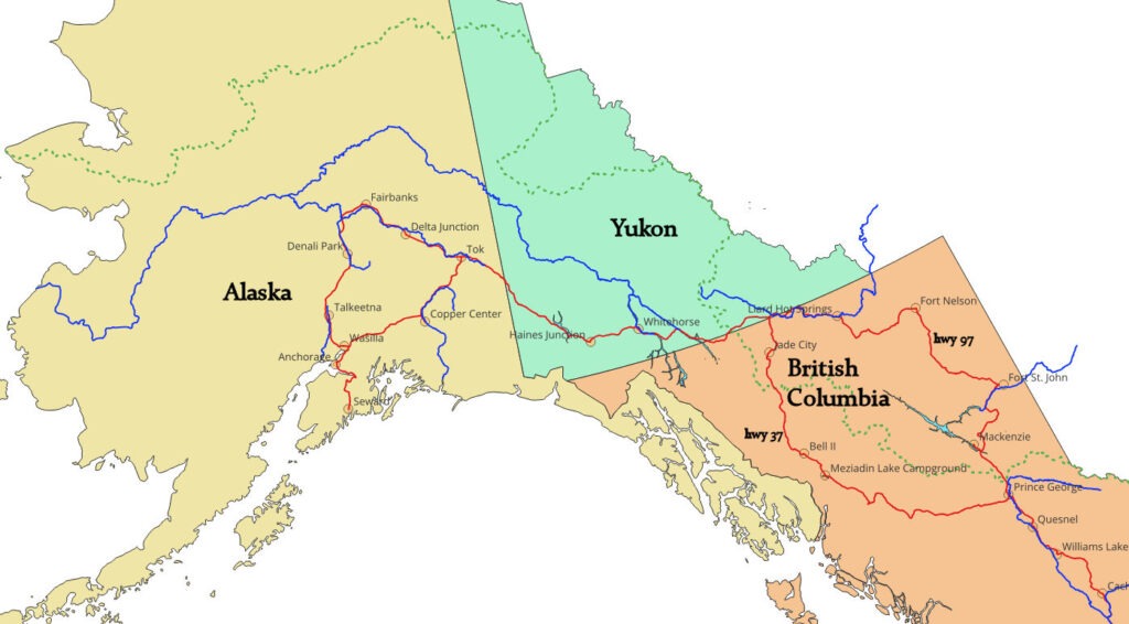
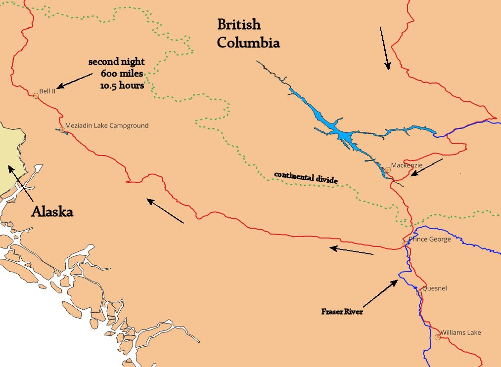
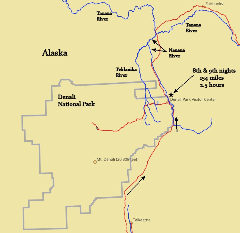
From central BC north, the following map shows our route through British Columbia, the Yukon, and Alaska. In BC, we went north on the more westward highway (37) and returned south on the more eastward one (97).
Our first day’s drive shows the southern part of BC:
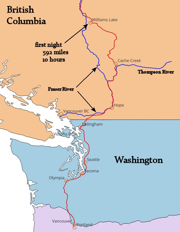
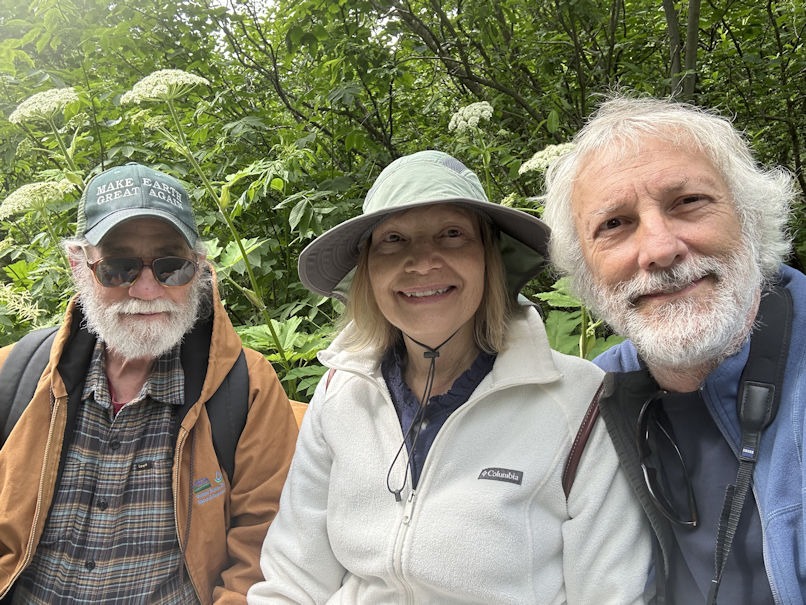
I intended to drive alone, but when Paul heard about this adventure, he had to go along. We worked on several projects over the years and spent time in the field together. I knew we would be compatible travelers. But how would our 70-ish bodies handle all that riding in the car? This was a key question for the first day.
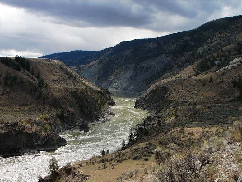
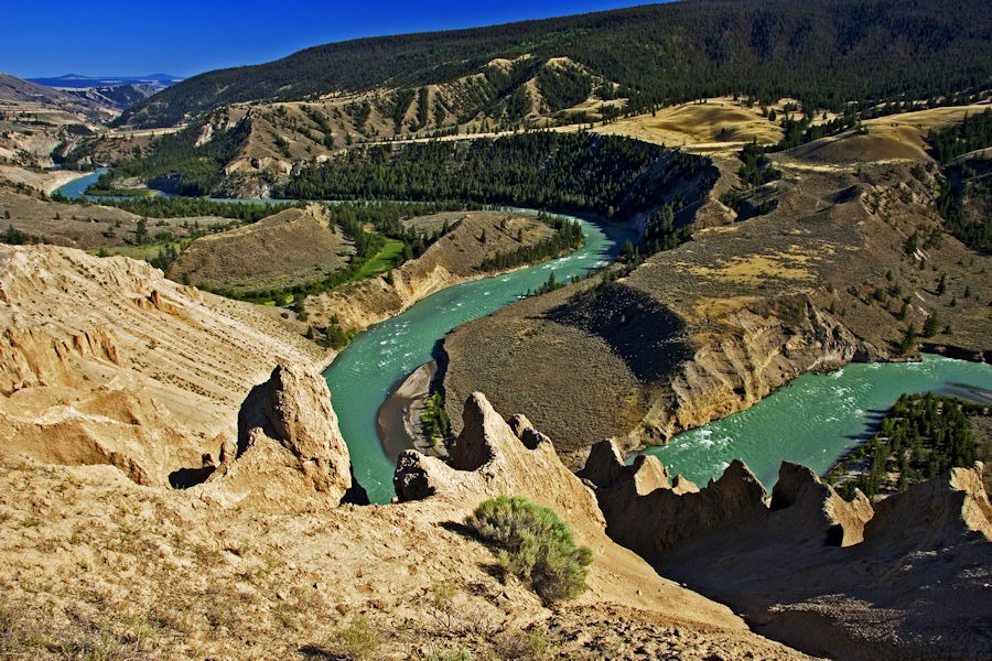
The border crossing into Canada was trouble-free, and we made our way up the beautiful Fraser River Canyon. The highway mainly hugs the eastern side, with the river flowing many hundreds of feet below until somewhat north of its confluence with the Thompson River.
from Tjflex2 on Flickr
https://www.flickr.com/photos/tjflex/4969890683/in/photostream/
We thought the first day’s ten hours would be the longest of the whole trip. The next two would turn out to be just as long. We stopped at a Best Western in Williams Lake, BC. The highway had moved further east, away from the Fraser River, but returned near Williams Lake.
Terrain near Williams Lake, BC. Photo from Chris Harris Photography on Flickr
https://www.flickr.com/photos/bcgovphotos/15798513250
Especially after a good night’s sleep, our bodies were not too stiff and seemed up for continuing. Day two took us away from civilization and into dense forested land.
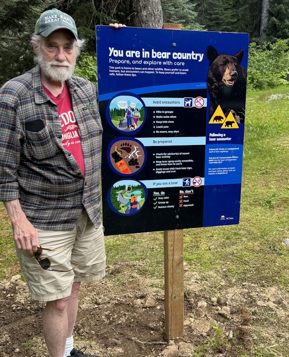
We had hoped to camp at Meziadin Lake Provincial Park (see map), but discovered that they were experiencing bear problems. A newly planted sign, below, warned of the situation, and another sign specifically banned tent camping. (That’s Paul.)
The evening was fast approaching, and we had slim hopes for anywhere to stay in the rustic country ahead.
from MikoFox on Flickr
https://www.flickr.com/photos/mikofox/36901885390/rom
We got lucky. In an hour, we came to the one possibility: Bell 2 Lodge, a northern oasis (as their website says). This is a winter destination for wealthy skiers who want to heli-ski. In other words, they book lodging at Bell 2 and get helicopter rides to the higher elevations of the nearby slopes for a wilderness ski experience.
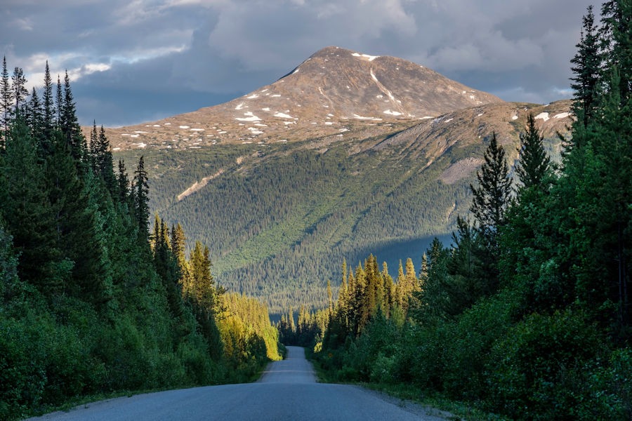
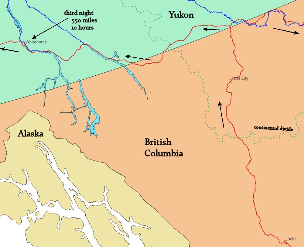
They had one room left, and we sighed in relief. At breakfast the next morning, a lone motorcyclist came into the lodge and chatted with us. He had come over the Continental Divide, not much farther north, and despite the July morning, said he almost froze his fingers off. Here’s our third day, which would take us into the Yukon Territory:
For informed map readers, note that the more northern maps have been produced using a different map projection than those further south. Alaska will look better, more correct!
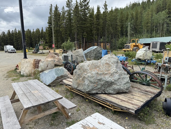
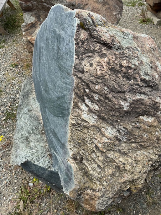
Before reaching the Yukon, we stopped at Jade City. As a geologist, Paul was familiar with this place and the fact that the area was a significant source of jade mining.
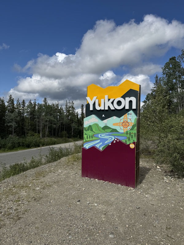
Finally, we crossed the Yukon border. Stopping to take the following photo, we also met a young Canadian on his way southward by bicycle. The bike was loaded down, and we learned that he had started in Anchorage and was headed to the southern tip of South America! Pascal Picard shared his website with us, saying that the purpose of his journey was to connect hearts through nature.
After getting gas and lunch at a place near the junction, we saw only a few towns all the way to Whitehorse. Places often had signs saying, “closed,” or “no gas.” The day three map, above, shows that we went over the Continental Divide, driving west on the Alaska Highway from BC Highway 37. Yet, the forested terrain was not mountainous like the Colorado Rockies. The Continental Divide was not apparent or marked with a sign.
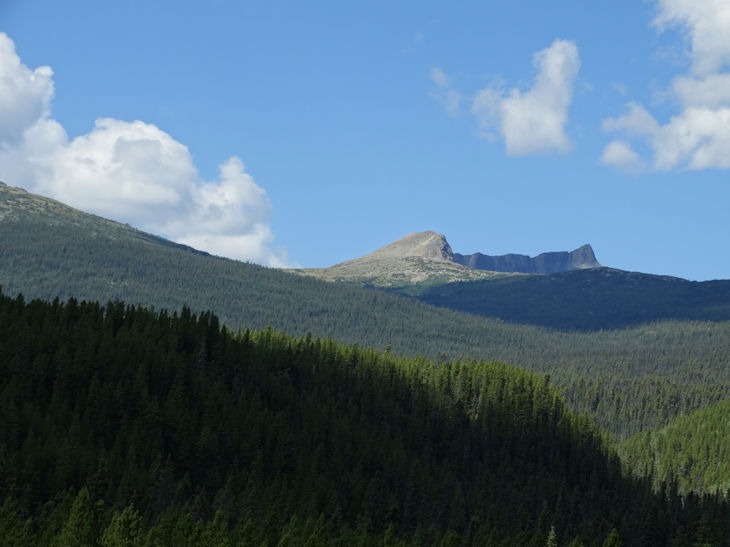
Photo by Adam Jones
https://share.google/images/zLAWZQGFFhLzkLOdq
Whitehorse, Yukon, is the capital of the territory:
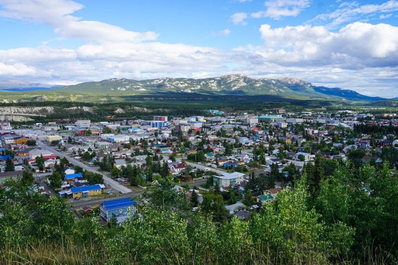
WhitehorseYukon. Photo by Louis White.
https://www.flickr.com/photos/192029718@N06/51064499152/
Day 4 would take us into Alaska:
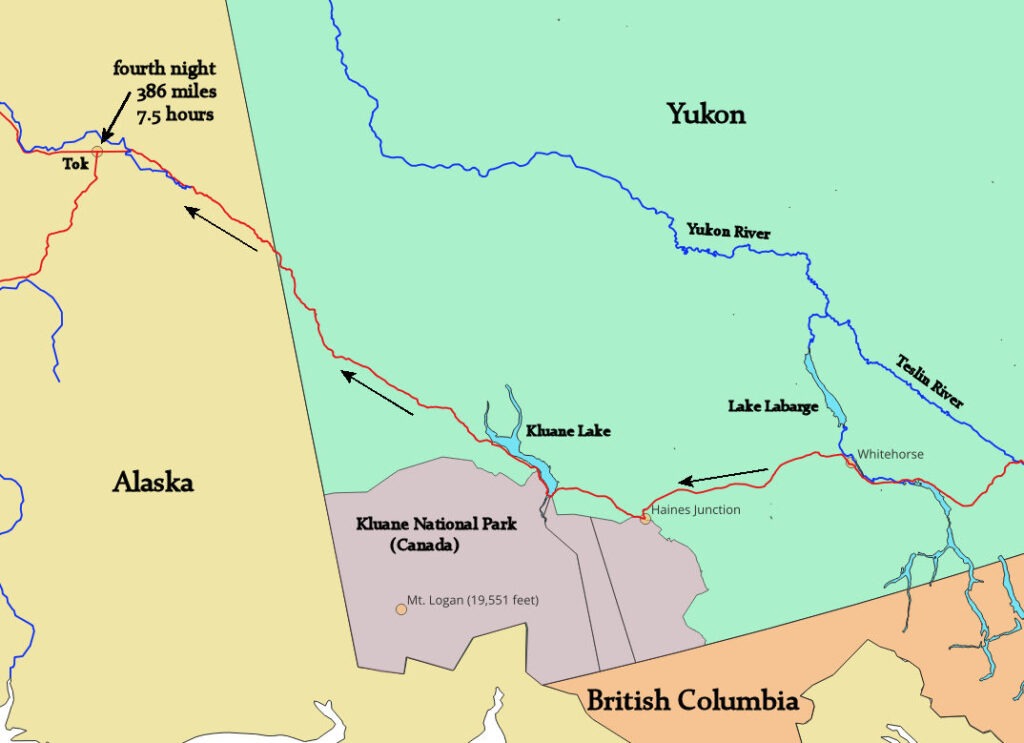
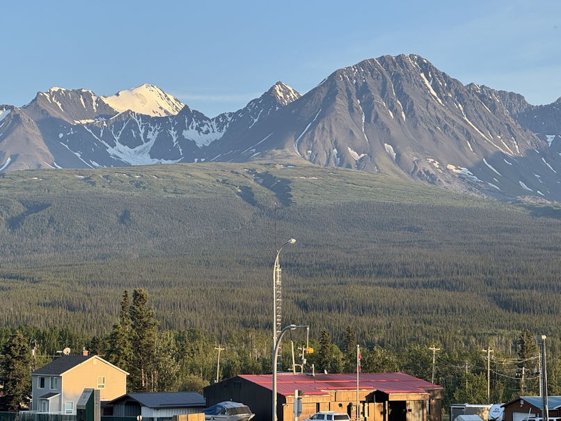
At Haines Junction, we stopped at the Kluane National Park Visitor Centre and learned about the mountain range to the west, crossing the border with Alaska. Mount Logan, at 19,551 feet, is the highest peak in Canada.
Shortly before the Alaska border, we came to a settlement (Beaver Creek) where we could get some lunch. Buckshot Betty’s was open, with no other customers at the time. Betty herself greeted us, took our orders, and went back to the kitchen to cook. The poster on one of the walls shows Betty in her younger days (below).
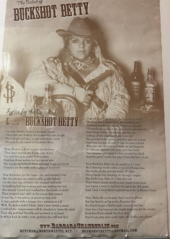
Well… ok, I must confess that she wasn’t really Betty. The elderly woman didn’t reveal her name, but she was probably Carmen Hinson, the long-time owner. A 2022 web page article states that she attempted to sell the place. We were glad she was still there in July 2025.
We crossed the actual border of Alaska about a mile before coming to the border checkpoint. Many travelers stopped to get photos, and so did we:
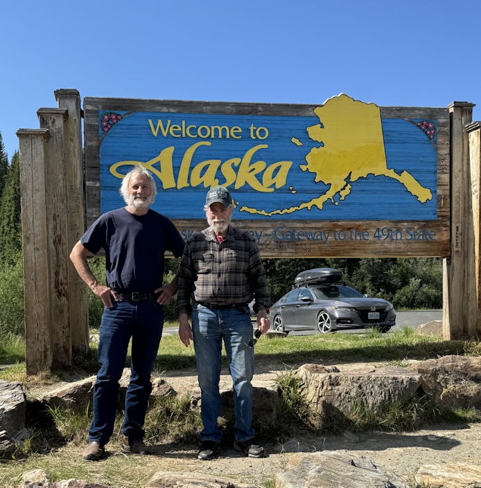
Only one car was ahead of us at the border, and we returned to the USA without incident. As we drove north to Tok, we debated how it should be pronounced. If they liked to chat, then it would be pronounced, “talk,” but if they were marijuana smokers, it would surely be pronounced with the “toe” sound, rhyming with “smoke.” It turns out the correct pronunciation is the latter.
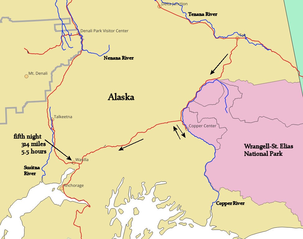
The fifth day of our trip would be our first relatively easy drive, in terms of mileage. Heading southwesterly, we soon followed the Copper River and were adjacent toWrangell-St. Elias National Park. This area, including parts of Alaska, Yukon, and British Columbia, features numerous mountain peaks exceeding 10,000 feet in height. Wrangell-St. Elias alone has nine of the sixteen highest peaks in the US.
Wrangell-St. Elias borders Kluane in Canada. These two parks, along with Tatshenshini-Alsek in British Columbia and Glacier Bay, further south in Alaska, form a UNESCO World Heritage Site due to their unique ecosystems.
Only a few miles out of the way, on the road toward Valdez, we went to the Wrangell-St. Elias Visitor Center. This is the largest of all US National Parks, and, similar to Denali, has minimal road access. This park is wild and dangerous. We headed back up the road and down to Wasilla, on Lake Lucille, just north of Anchorage.
This would be our last night before picking up Diane at the Anchorage airport. Our motel room faced the lake and was near the end of a wing. We could see the private property next door and something rather odd-looking. The house had a lawn sloping gently about 80 feet to the lake shore, where a pier was available to tie up boats. Next to the pier, however, was a small helicopter. We saw a man walk down from the house, get in the craft, start it up, and take off over the lake. Perhaps he had an errand to pick up a few groceries. The following photo is not the same helicopter, but a similar small model.
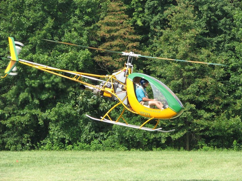
Photo by Jim Manley at the English Wikipedia, CC BY-SA 3.0
https://commons.wikimedia.org/w/index.php?curid=33135267
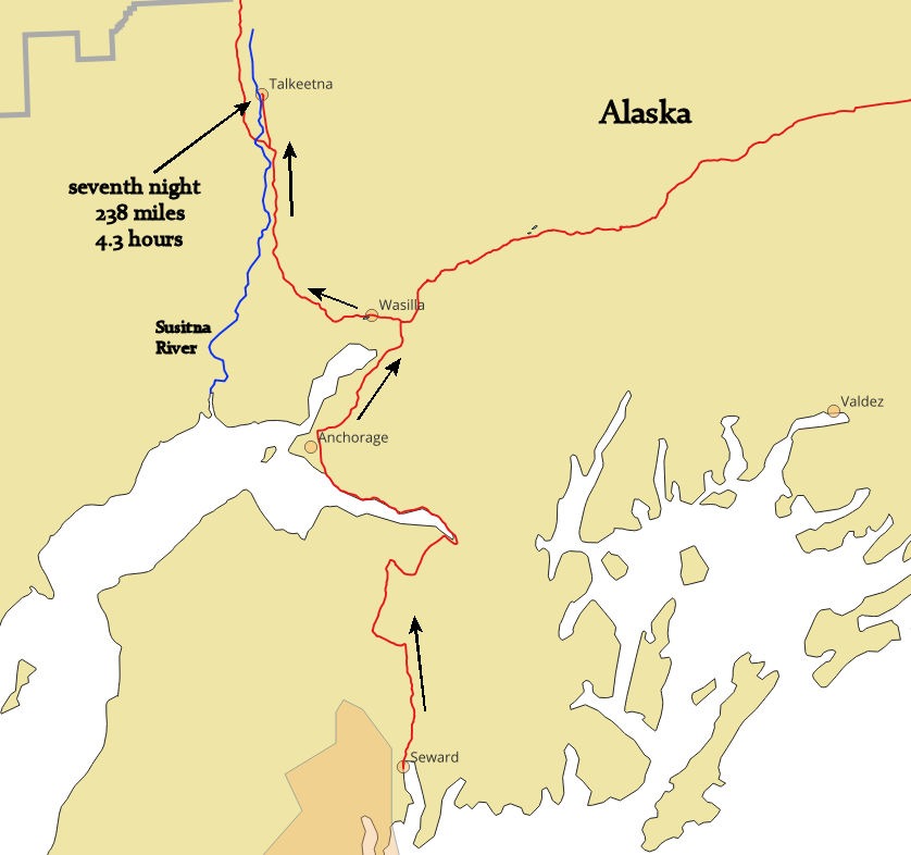
The next morning, we had a short half-hour drive to the airport to pick up Diane. Then we drove about two hours south to Seward, as shown on the day 6 map:
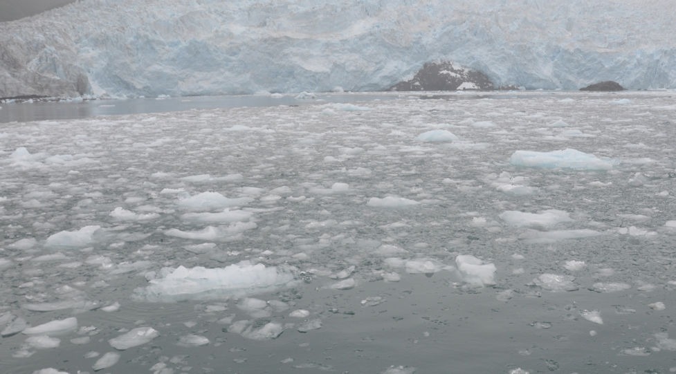
We arrived at Kenai Fjords National Park in time to catch a ranger-led walk to see the Exit Glacier, so-called because a 1968 mountaineering expedition crossed the Harding Icefield, descending the valley glacier and ending the trek by exiting at the terminus of this glacier.
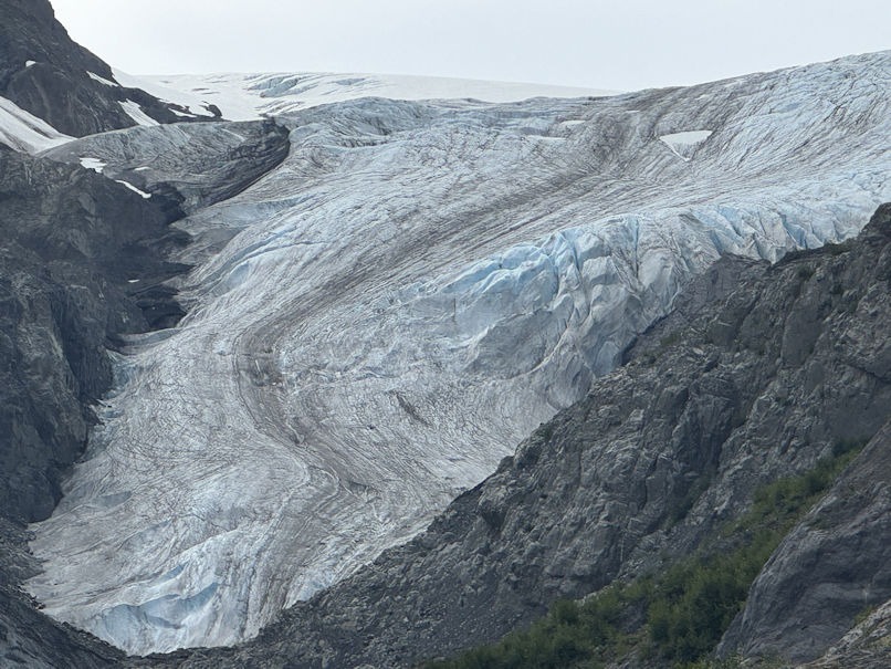
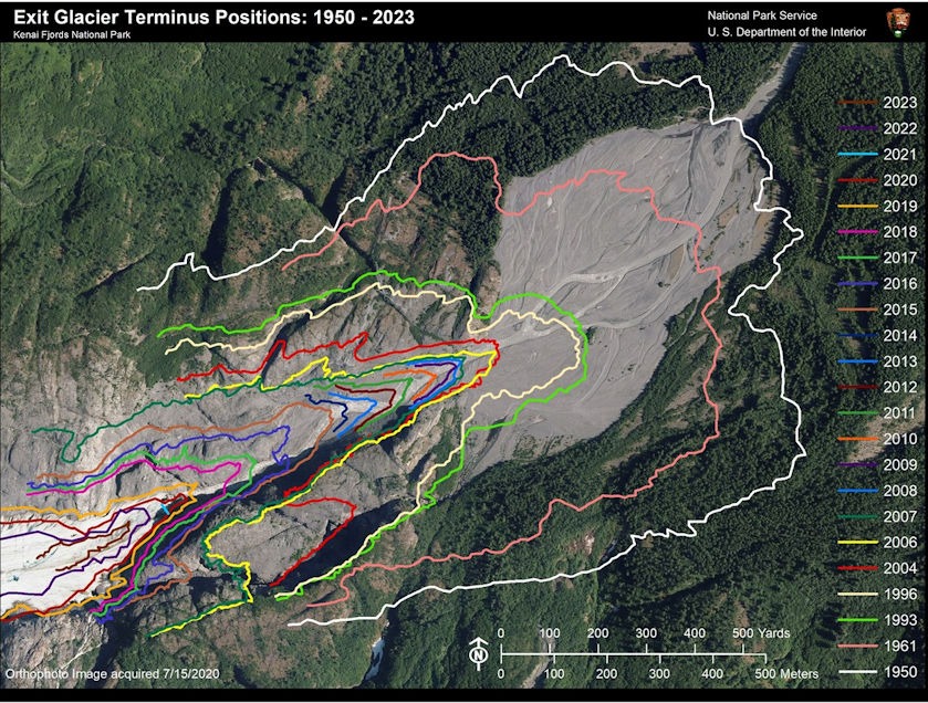
The ranger led us along a gravel path with periodic small signs posted with four-digit years. These successive signs showed where the edge of the glacier had been between 1950 and the present. Here’s an aerial view from the park’s website:
The glacial melt forms a gravelly stream:
We spent the sixth night in the little community of Seward and enjoyed a seafood restaurant overlooking Resurrection Bay. The following day, we caught an early boat ride out to the fjords. This was sightseeing in the extreme. Many animals busied themselves either onshore or in the water.
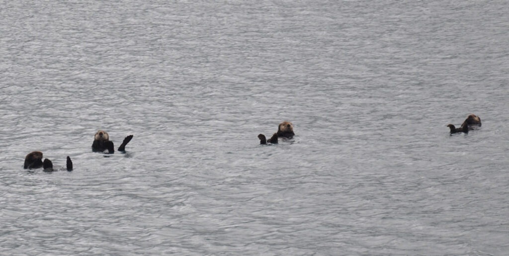
Sea Otters seem to enjoy watching a boatload of tourists.
The tour highlight was watching feeding humpback whales. They had gathered in a side inlet teeming with chunks of floating ice:
Diane and I remembered times when we had seen humpback whales in the waters off Maui. In Hawaii, the mothers give birth to their calves and nurse them, but the seawater there is devoid of a food source. They must swim all the way back to their Alaska feeding grounds before they can replenish themselves.
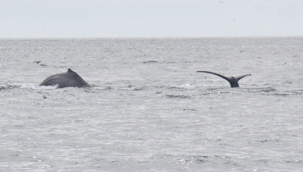
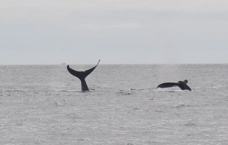
According to our narrating boat captain, the whales work together to corral herring or other small fish. They circle the herring schools and form them into a rising column. When they force the fish toward the surface, the keen-eyed seagulls let everyone know where to look.
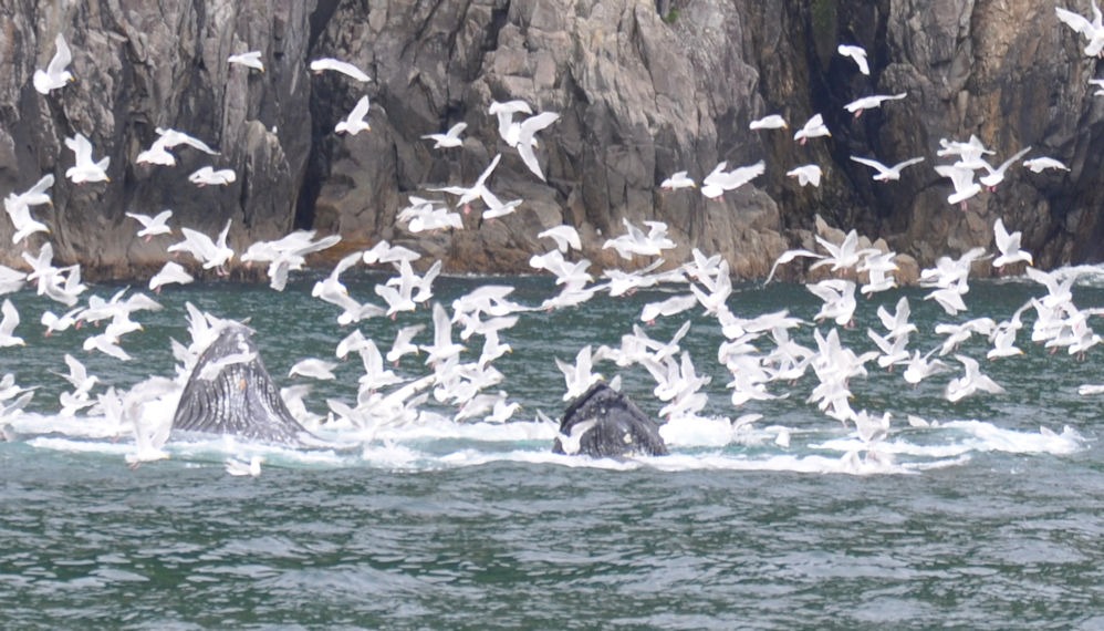
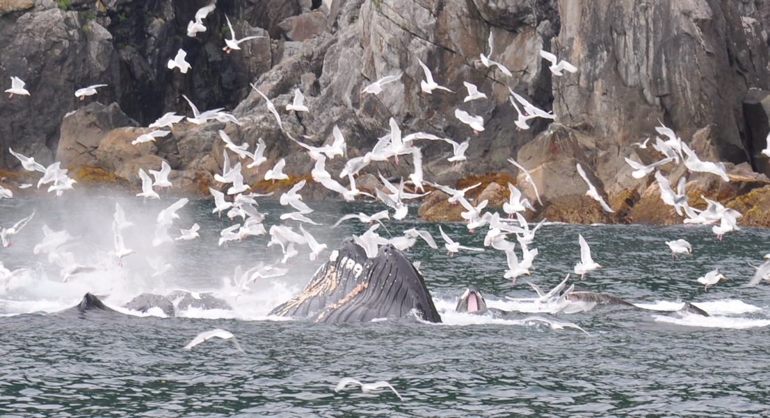
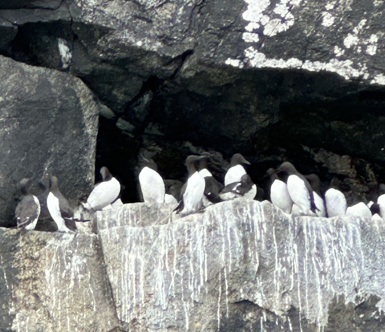
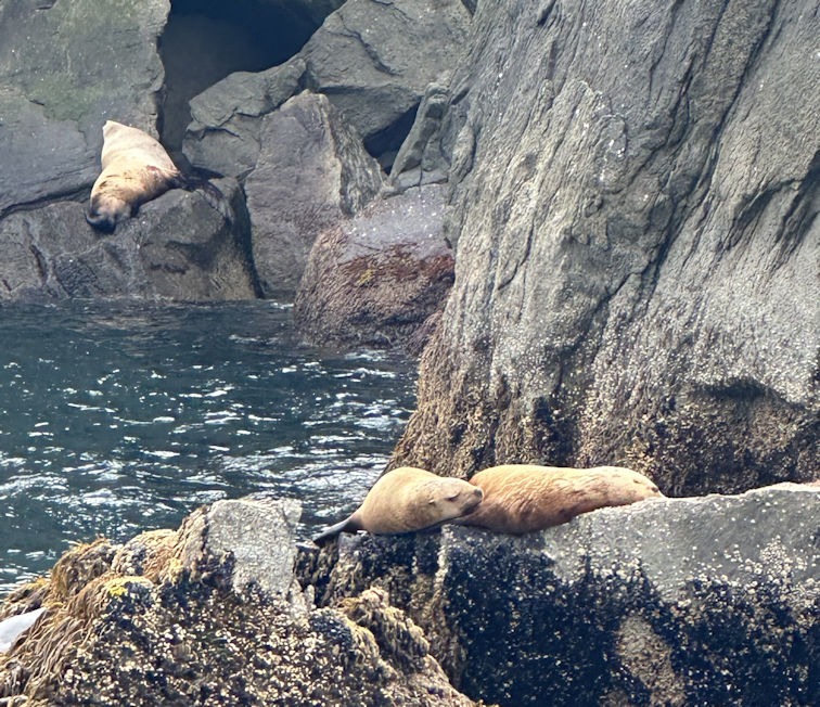
Notice the pink in the open mouth of one of the whales on the right. The foreground whale has a few barnacles hitching a ride. We also saw dolphins, but were unable to catch a pic. Various wildlife lounged on the rocks, such as harbor seals and murres. According to Wikipedia, the common murre is a large awk, not an arctic penguin, and a capable flier.
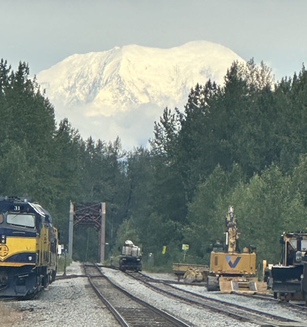
That same day, we drove north to Talkeetna, The Gateway to Denali. This small community is often used as a base by climbers of Denali’s peaks. We stayed at the Meandering Moose Lodge, which, I knew from the name, Diane would not want to pass up.
As shown on the day 8 map below, Talkeetna is geographically close to the Denali peak. On day 8, we had a short drive to Denali National Park and booked two nights at the Grande Denali Lodge, just outside the park.
Talkeetna often provides views of Denali that elude park visitors. Diane caught the following photo as we crossed the tracks to head north.
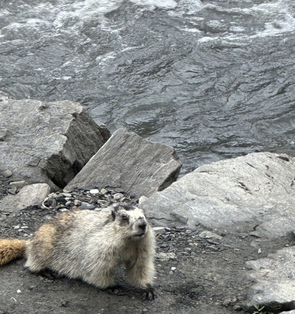
On the first day at Denali, we drove as far as cars can go, to Mile 15, and took a short hike along the Savage River. The loop trail is short and relatively flat, offering a preview of the park’s environment. A marmot was busy looking for food in the stream:
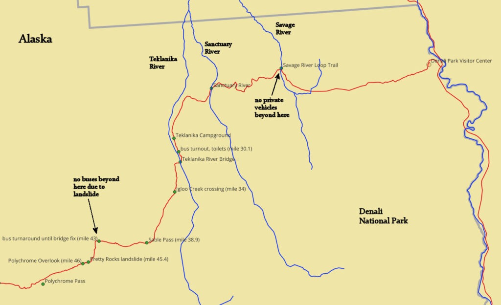
A map of the park road shows the Savage River crossing. Visitors can ride a free bus to visit further into the park. A second type of bus tour is worth reserving and paying for: narrated by knowledgeable drivers who also happen to be keen-eyed wildlife spotters.
The bus driver also had a telescope connected to drop-down screens for passengers on the bus. This was a significant benefit, as we all enjoyed seeing the wildlife with our own eyes at the actual distance, while also being able to see closer-up views on the screens.
The most enjoyable sight was a mama grizzly bear with two cubs, probably two thousand feet off the road. She was ambling along with the cubs in tow. The close-up view showed the cubs playing with each other and doing somersaults.
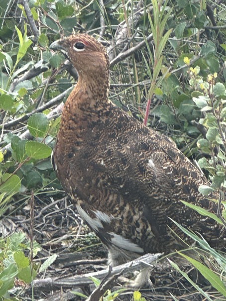
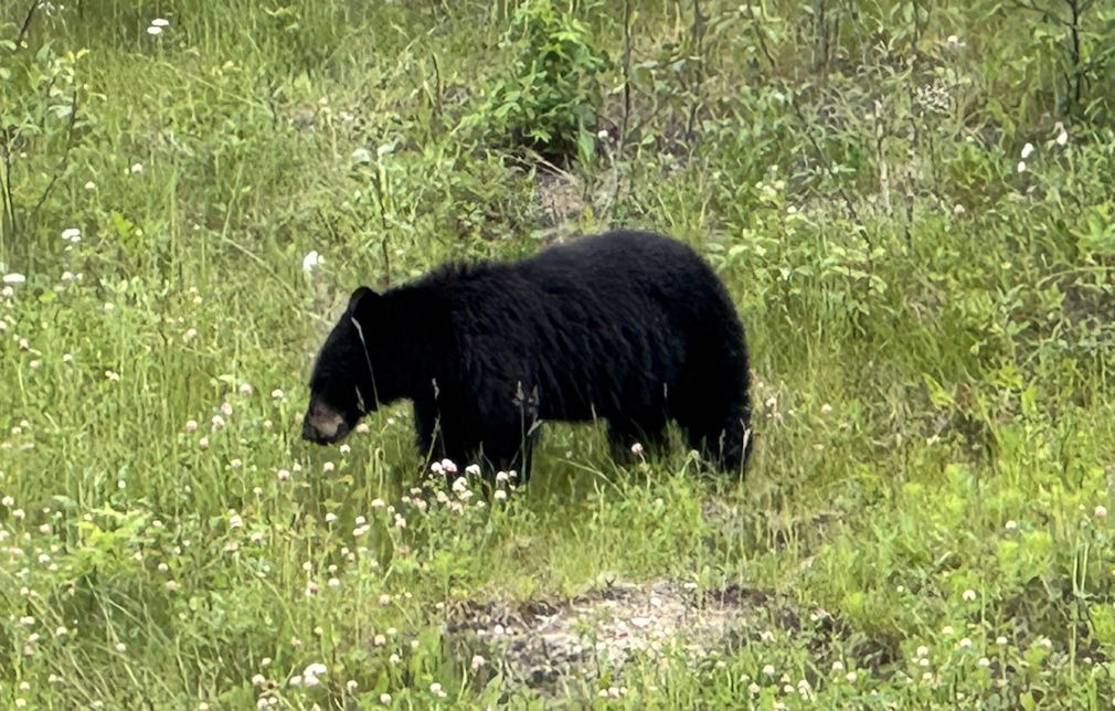
Other sightings were caribou and a lone black bear. Along the side of the road, we saw porcupines and the state bird of Alaska, the ptarmigan. Shown below is a mama ptarmigan, and several of these had many chicks following them, sometimes crossing the road in front of the bus. These birds turn white in the fall.
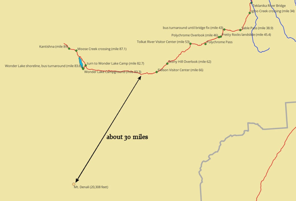
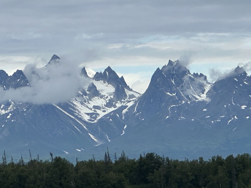
The following map shows the Park Road to its end, which will not be reopened until 2027. Note, in the upper right of the map, that the buses currently turn around at mile 43. The landslide, which took out the road, was at “Pretty Rocks,” mile 45.4. Another visitor center, currently closed, is at mile 66, and the end of the road at about mile 89. Mount Denali remains about thirty miles from viewpoints along the route.
Denali offers beauty far away, but also close up.
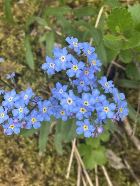
Woodland Forget-Me-Not
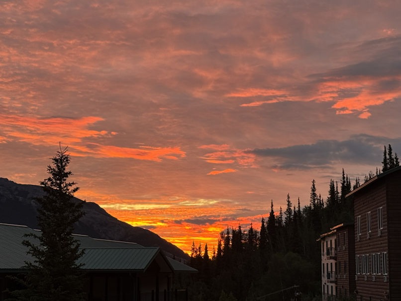
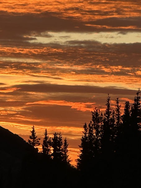
Before heading northward to Fairbanks, we stayed up late to catch the midnight sun:
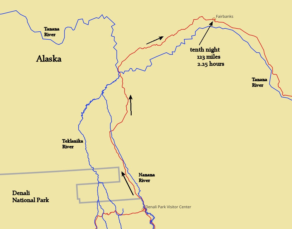
Driving to Fairbanks on day ten, we passed through a previous wildfire area that had burned both sides of the highway.
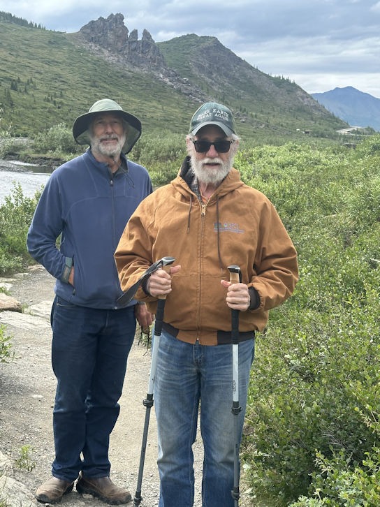
We enjoyed a Fairbanks pub before dropping Diane at the airport. Paul and I had yet a few more adventures ahead of us. Paul’s green hat reads, “Make Earth Great Again.” He received many compliments on that hat, all the way up through Canada and everywhere in Alaska.
The drive on day 11 would be a new road southward for us, through Delta Junction, before we came back to Tok. We would keep going to Haines Junction.
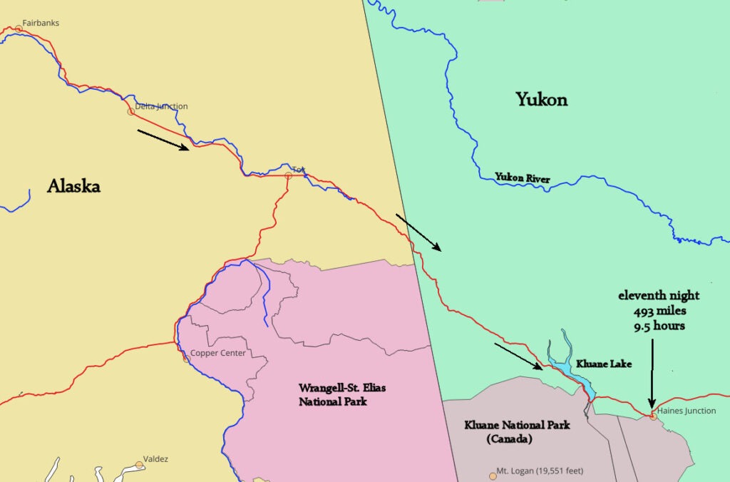
From Haines Junction, we would retrace our return route through Yukon until the junction of Highway 37, where, instead of turning right, we would continue on the previously untravelled Alaska Highway 97.
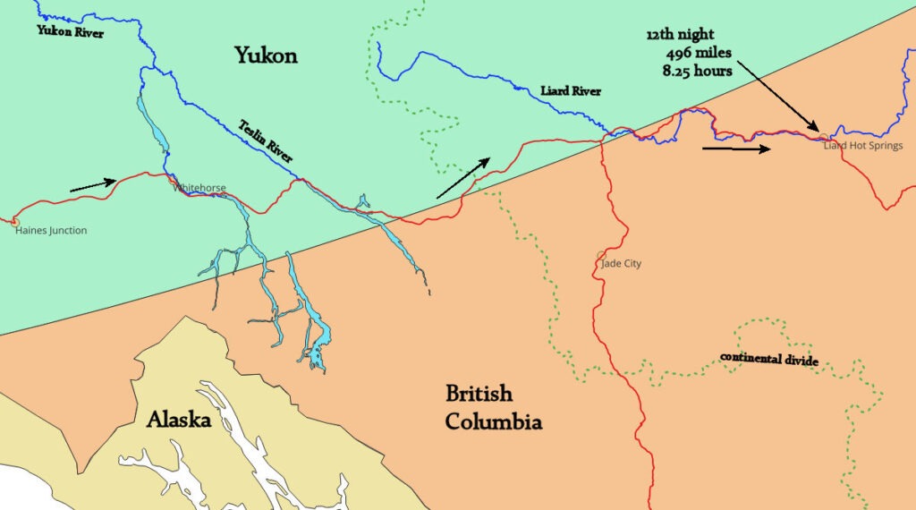
On the Alaska Highway toward Liard River, we had several wildlife sightings along the highway. A lone black bear, a couple of separate herds of wood bison, and a herd of bighorn sheep.
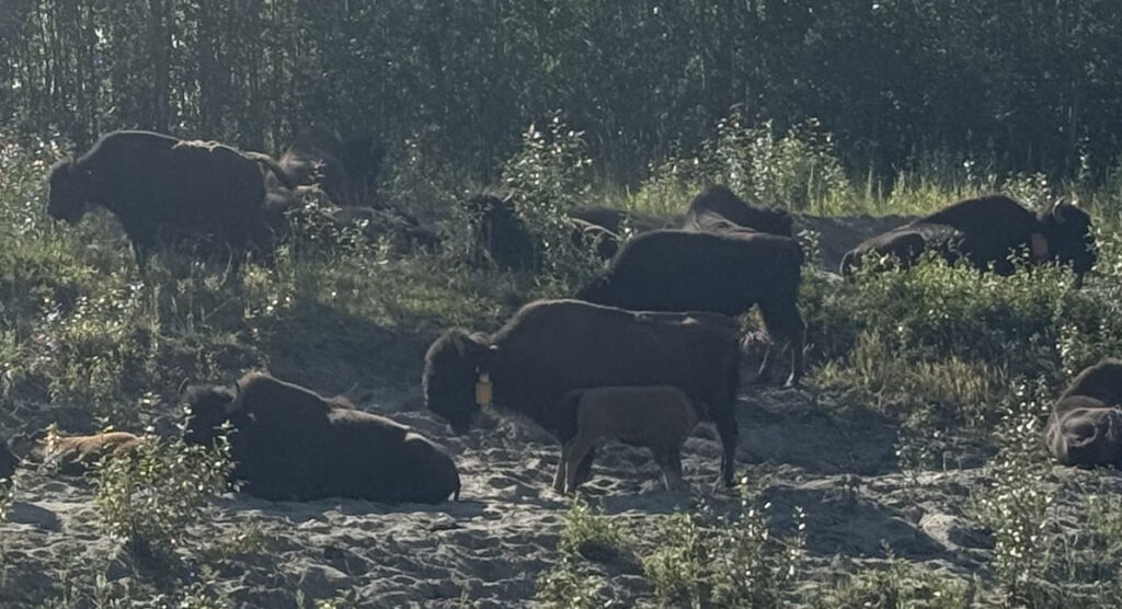
Note the nursing calf.
The bighorns were annoyed by having to get out of the way of an oncoming semi truck:
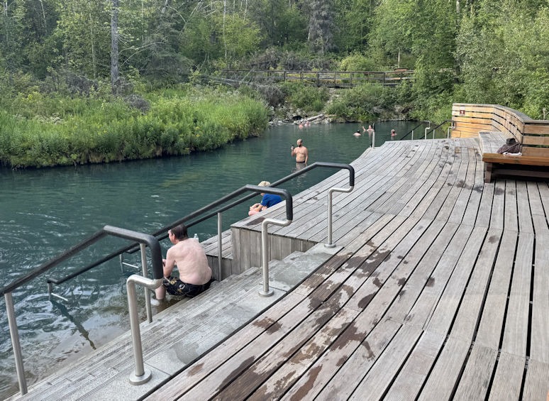
We stayed at a rustic motel across the road from Liard Hot Springs Provincial Park. The hot springs was large and the park had built a deck and stairs for convenience.
.
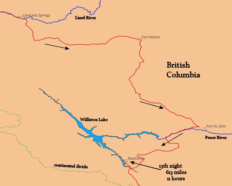
The next day, we returned to areas of greater population. The first hotel we asked was full. We found lodging in the town of MacKenzie. This place at the end of a dead-end road seemed to have no purpose other than a supply hub for the Williston Lake area fishermen, hunters, and trappers.
We returned to the previously travelled highway at Prince George and back along the Fraser River. At the town of Quesnel (pronounced keh-nell’), we stopped at one of Canada’s favorite donut shops, Tim Horton’s. As we sat down with coffee and donuts, an older gentleman spoke to me.
“Are you from California?” he asked.
I wondered how he could get that impression and said no. Then he said, “Colorado? Arizona?” It seemed he just wanted to chat, so we talked with a group of elderly Canadians:
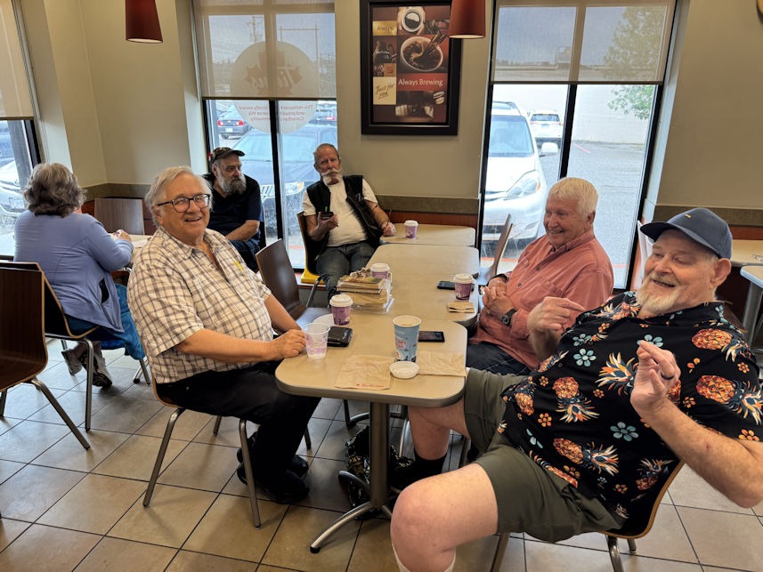
They complimented Paul’s hat, and we assured them that we didn’t think we were all sitting in the 51st state. They said that Americans who voted against Trump always told them so, and those who voted for him didn’t say anything.
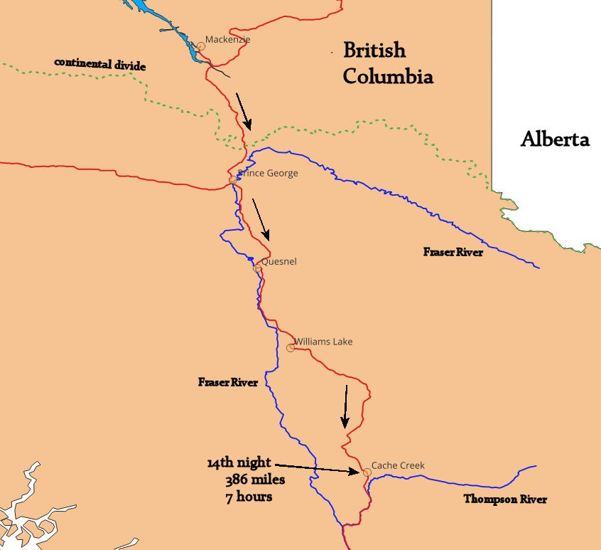
As Paul and I continued south, we noticed something interesting that we had missed while driving north. Somewhere between Williams Lake and Cache Creek, the climate changed. It seemed much drier, and the trees had thinned out, replaced by brown grass. We spent the night at Cache Creek, where a mysterious wind blew so hard that part of the hotel’s roof flashing came down.
On the fifteenth day, we headed out of Cache Creek without coffee or breakfast. The highway squeezed into the Fraser Canyon, and we had to stop for a significant road construction project. It wasn’t until we arrived in Hope, BC, that we found a café and grabbed a bite to eat.
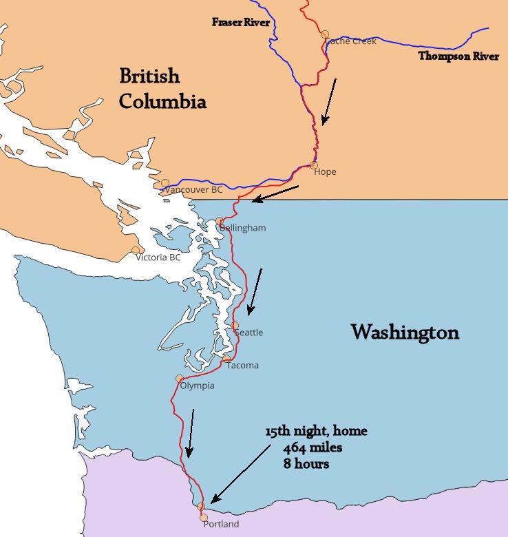
Crossing back into Washington State went smoothly. It was a Thursday afternoon, but I-5 was heavy traffic from Bellingham to Olympia. Clearly, the population had skyrocketed between Upper British Columbia and Oregon. Yet, one should not favorably judge northern areas as livable by experiencing them one summer month of the year.
It was a great trip.
It WAS a Great trip !!! Thanks for posting this memoir.
-diane
This was such a nice report! Thanks. It makes me want to go.