I investigated several wildfire-ravaged landscapes during my career, and the Hermosa Creek watershed in Colorado was one of the most beautiful. This post is meant to show some of Earth’s more recent climate change challenges, not to be particularly political. Let me explain the catchy title. In Spanish, the word colorado means “colored red” or “ruddy.” The state acquired the name after it had already been applied to the Colorado River, due to its reddish sandstone channel features. (I guess Colorado is not that red, politically.)
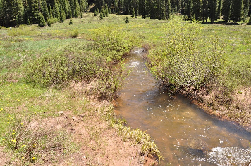
Having explored Hermosa Creek, I can also attest that the Spanish word meaning “beautiful” is also aptly applied. The upper end of the watershed was not burned in the 2018 fire that I discuss here. So the following photo provides a first glimpse.
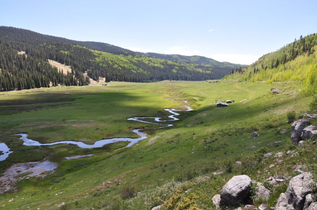
Colorado has many high-elevation meadows like this one. If you saw the Coen Brothers movie, “The Ballad of Buster Scruggs,” you may be forgiven for the mistaken idea that part of it may have been filmed here at Hermosa Creek. Instead, the gold miner scenes were shot at the Upper Piney River, which contains a similar marshy winding creek:
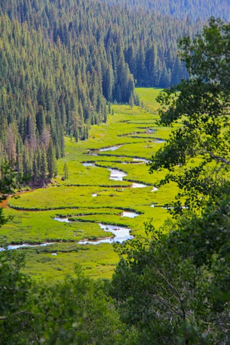
credit: Sylvia Murphy
That river is about 65 miles west of Denver, just south of I-70 near the Continental Divide, across from the headwaters of the Arkansas River. (See state map below.)
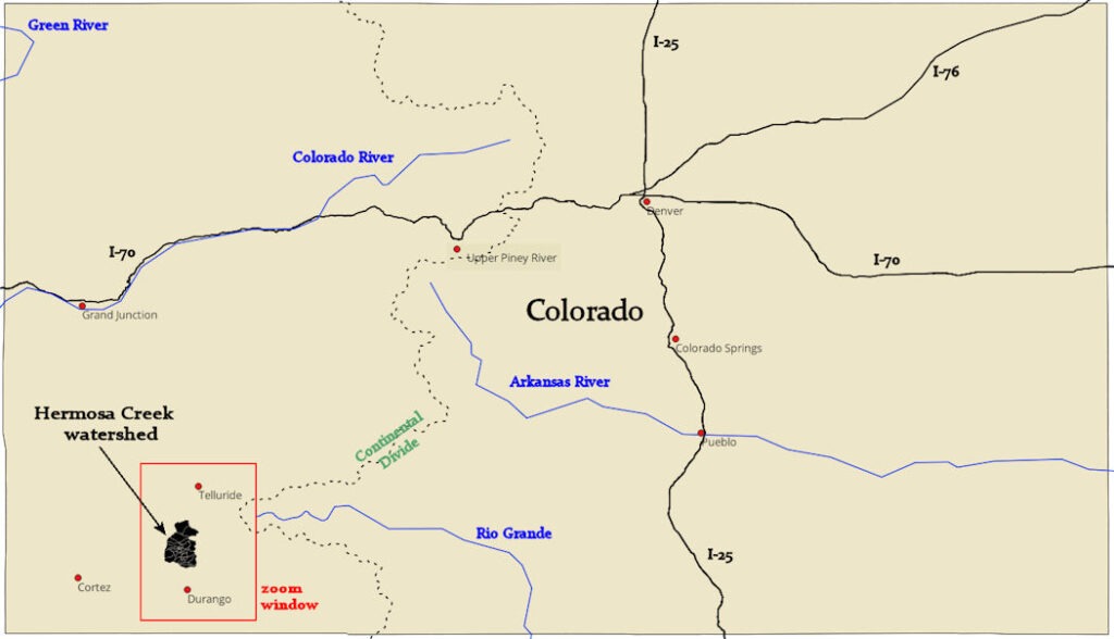
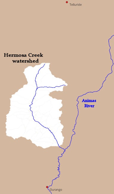
Zooming in on Southwest Colorado, as shown below, Hermosa Creek is just north of Durango and contributes to the south-flowing Animas River. The Animas flows into the San Juan River, which joins the Colorado River in Southern Utah, at Lake Powell, upstream of the Grand Canyon. The town of Telluride is due north of Hermosa Creek.
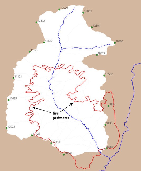
Hermosa Creek watershed is about 169 square miles and rimmed by numerous peaks of elevations over ten thousand feet. The lowest streambed elevation is about 6600 feet, entering the Animas River. As shown below, the fire perimeter contains the lower end of the watershed and mostly does not include the high rim. The wildfire was named the “416 Fire,” and, as discussed in Wikipedia, was considered to have been ignited by sparks from a tourist train operated out of Durango.
My project was to create a computer model to analyze the rainfall-runoff process in Hermosa Creek. This would help determine the expected increase in flow and debris in Hermosa Creek caused by the fire. The model uses mathematical relations that compute how rainfall will either infiltrate the soil or run off into channels, and then how much channel flow will accumulate and how long it will take to reach the downstream end.
Any good environmental scientist knows that field investigations are a must. We use computer models to account for the impactful physical processes. The modeler must decide what is important and what isn’t. Crucially, these factors must be spatially accounted for. The watershed modeling task also requires a certain amount of subdividing the drainage into a series of contributing flow areas, which borders on bringing intuition and creativity into science. (This happens more than most people think!)
An older colleague of mine used to say, referring to environmental computer modeling:
We’ve got lumpers and splitters in this business, Dan, and you are a splitter!
The key difference is that too much lumping may smear over important geographic factors, whereas too much splitting may be a waste of time (and therefore money). Field visits help determine where to lump and where to split. In general, the modeler wants to subdivide when any factors that affect runoff change from one sub-basin to another. These could include a large array of aspects, such as land slope, sub-basin shape, vegetation, soil type, land use, whether the sub-basin burned, and if burned, how severely.
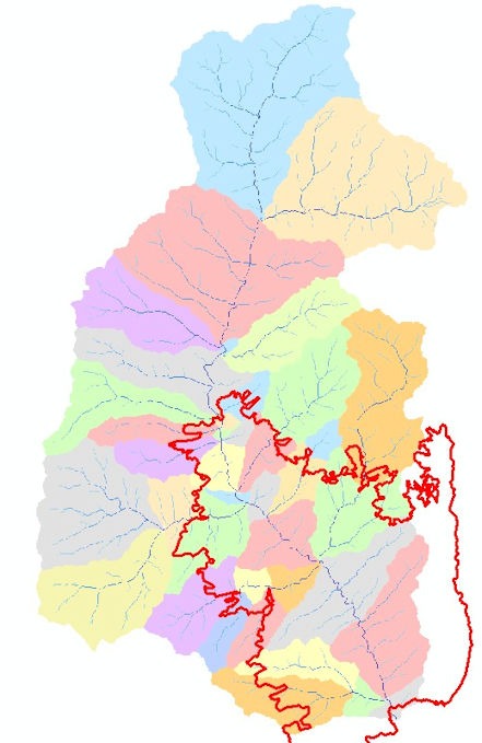
I will share field trip photos below, but first, a map of the result, showing how the Hermosa Creek hydrologic model was split into sub-basins:
The US Forest Service routinely sends teams of investigators to a wildfire location as soon as possible after the fire. These are called BAER teams (burned area emergency response). Their focus is to identify immediate dangers posed by the fire to human life and property. Another important effort by the US Geological Survey uses remote sensing to assess the geographic extent of the burn and its severity on the soil. These science-based agencies perform important public services that may be undercut by politicians who want to paint the government as merely wasteful.
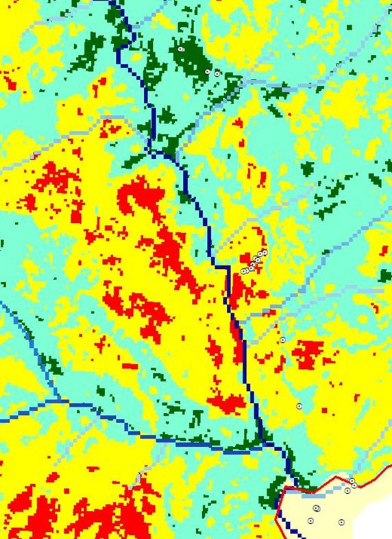
The soil burn severity mapping is helpful for modeling and for determining important areas for field visits. Below is a portion of the Hermosa Creek burn map, showing little white circles. These circles are places I visited in the field, some unburned, some moderate, some severe. In the lower right corner, I took photos from outside the burn, but overlooking the downstream end. This USGS site discusses soil burn severity mapping.
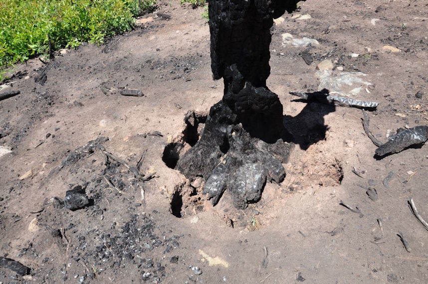
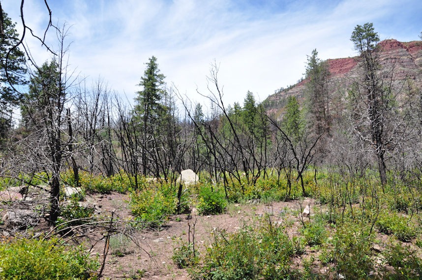
Here’s how the landscape looked a year after the fire:
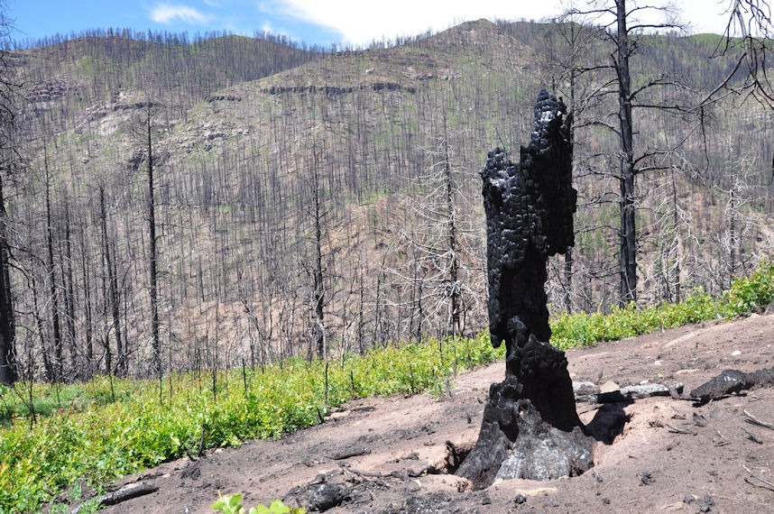
This severe burn area reveals that the fire heated the soil so much that even the underground roots burned. (Note that the holes around the roots were created by the fire, not by field investigation.)
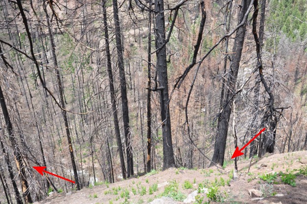
This photo shows a typical landscape along the lower reach of Hermosa Creek that was burned. The creek is at least 100 feet below, with very steep slopes on either side. This steepness contributed to burn severity, as the rising heat from burning below easily ignited trees further upslope. Note the red arrows that show the Hermosa Creek channel, far below, going out of sight beneath the steep bank, and difficult to discern.
Severe soil burning causes a phenomenon that contributes to elevated post-wildfire flooding. Scientists call it hydrophobicity, which means “fear of water.” The actual effect is that the soil will not absorb rainfall when organic compounds created by the fire have permeated it. Here’s a photo, then further explanation:
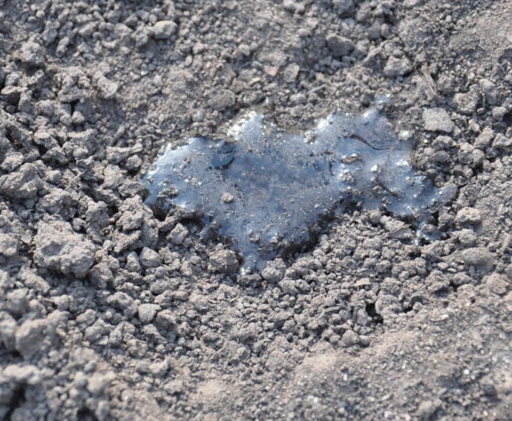
When the fire first burns vegetation, it vaporizes certain organic compounds. The heated and infused air seeps into the soil and ashfall. At some depth, the soil may be cool enough that the organic compounds precipitate out of gaseous form and become a liquid in the soil. When the area cools further, the liquid dries in the soil to a cemented, impervious layer. Often, the impervious layer will be found beneath either an ash layer or a pervious soil layer above it. If runoff from a storm rolls across this area, it may pick up ash and upper soil layers and easily erode them like a hosed sidewalk. Here’s a photo of ash above the hydrophobic layer. The wet spots show that moisture can infiltrate the ash. But below, it can sink no further than the hydophobic layer.
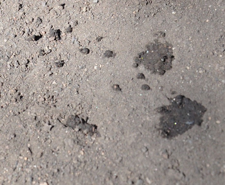
Here’s a video showing how hydrophobicity is investigated. Water drops are carefully dripped. First, on a surface-level ash layer. Then the ash is removed to determine at what depth the soil becomes hydrophobic. On the 2nd try, the water droplet soaks in. On the third try, the droplet stays as a bead, as if it were on an oiled frying pan.
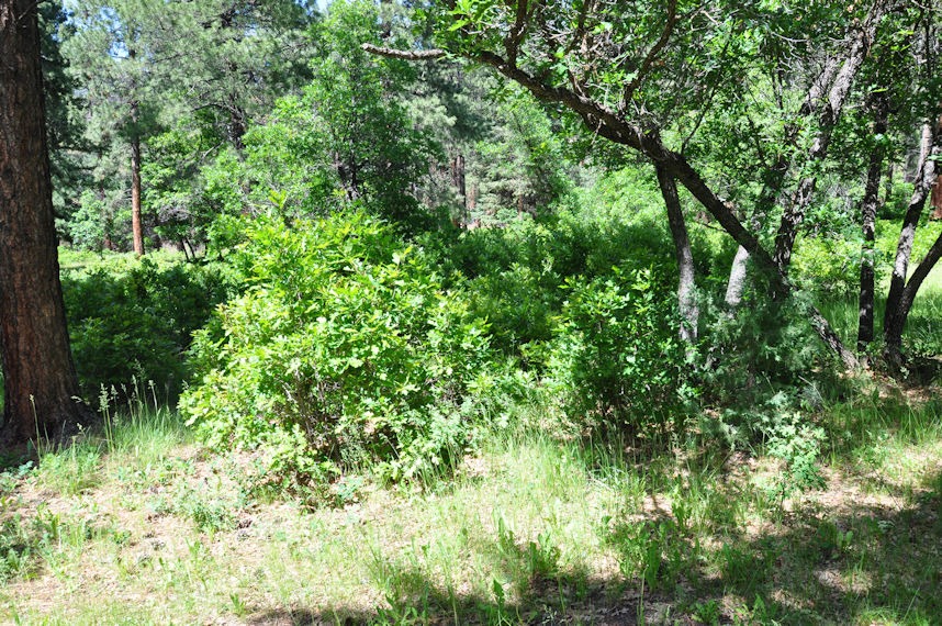
In the areas of less intense burning, scrub oak was quickly returning:
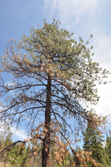
Many trees survived because the burn did not reach their height:
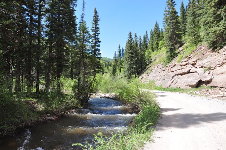
The following photo overlooks the lower end of the basin that was not burned.
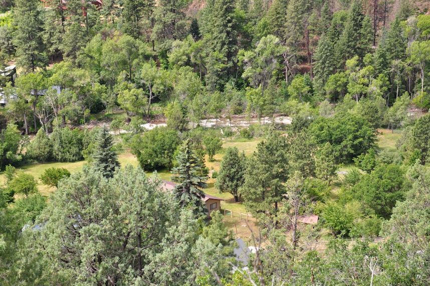
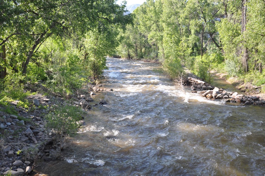
Here is Hermosa Creek in that area:
watershed model output
The computer model simulates the landscape, breaking the watershed into the drainage subareas shown above. The runoff of each of these depends on their vegetation, land slope, stream slope, stream roughness, and the amount of rainfall received. When modeling a future condition, rather than a past flood event, the amount of rainfall is determined by the statistical analysis of NOAA (National Oceanic and Atmospheric Administration).
I would expect many of my readers’ eyes to glaze over if I get too technical, so I will skip over many details. If anyone wants a more complete documentation of the analysis, let me know via the contact form.
Here’s a graph of the rainfall used in the computer model:
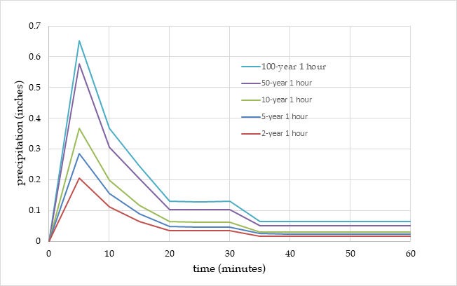
The graph not only shows different amounts of rainfall for different likelihoods, but also how it is distributed in time during a given event. Regarding frequency, note that a 100-year event has a 1 percent chance of happening in any year. A 2-year rainfall has a 50 percent chance of happening in any given year. These graphs vary across the country. Note that the above graph shows rainfall events lasting only one hour. That is due to the fact that Southwest Colorado’s most impactful storms are monsoon-type, relatively sudden bursts.
The output graph below is shown for a 10-year frequency event (having a 10 percent chance each year).
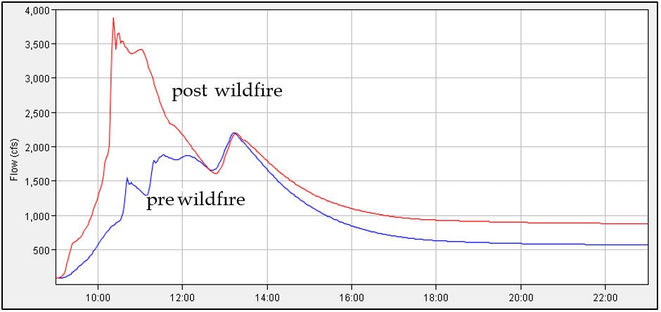
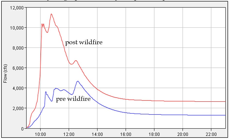
The Y-axis shows the amount of flow in Hermosa Creek at the downstream end of the watershed. The value “cfs” refers to “cubic feet per second.” This unit is a typical way to report streamflow, also called a flow rate. The X-axis shows time of day in hours. The effect of the wildfire is significant. This hydrologic analysis would be followed up by a hydraulic analysis, which would examine individual stream cross-sections to determine how much flow they can accommodate before flooding over their banks. Here’s the output graph for the more rare 100-year event:
Another effect of wildfire is that the stream channels can become clogged with debris. The debris can consist of mostly mud and ash, but can include boulders, logs, and tree branches. The US Geological Survey runs computer analyses in many post-wildfire watersheds to assess the likelihood of these debris flows in the immediate few years after a fire. For Hermosa Creek, here is a map of their analysis:
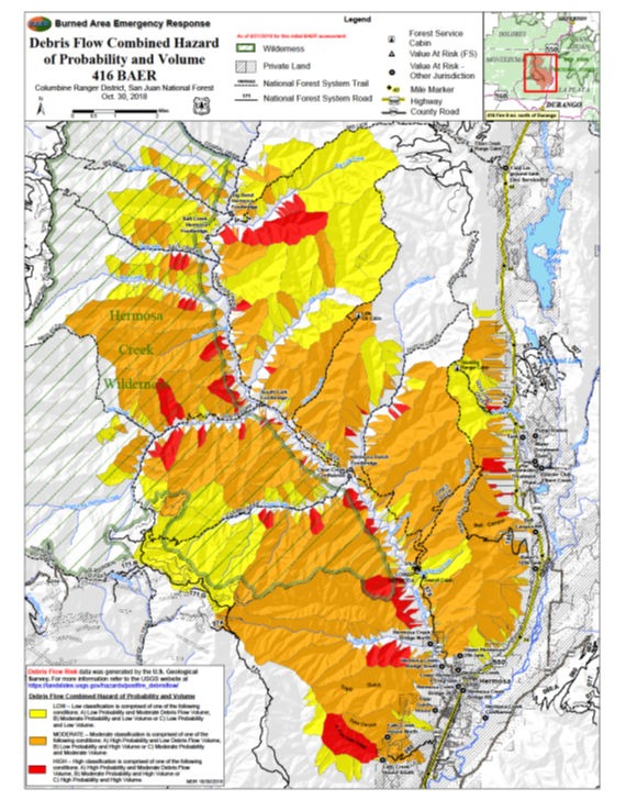
The legend is not readable, but the bottom line is that the Hermosa Creek burned area has a few pockets (red) where significant debris flow may occur. The orange areas are expected to be less vulnerable, and the yellow even less so. The effect of this debris on flow in Hermosa Creek was shown to be minimal, bulking up the peaks by only a few percent.
My field trip to Hermosa Creek showed part of what makes Colorado so beautiful. Here are two more photos of the upper basin that was unburned.
It would be worth a return trip for backpacking or fishing!