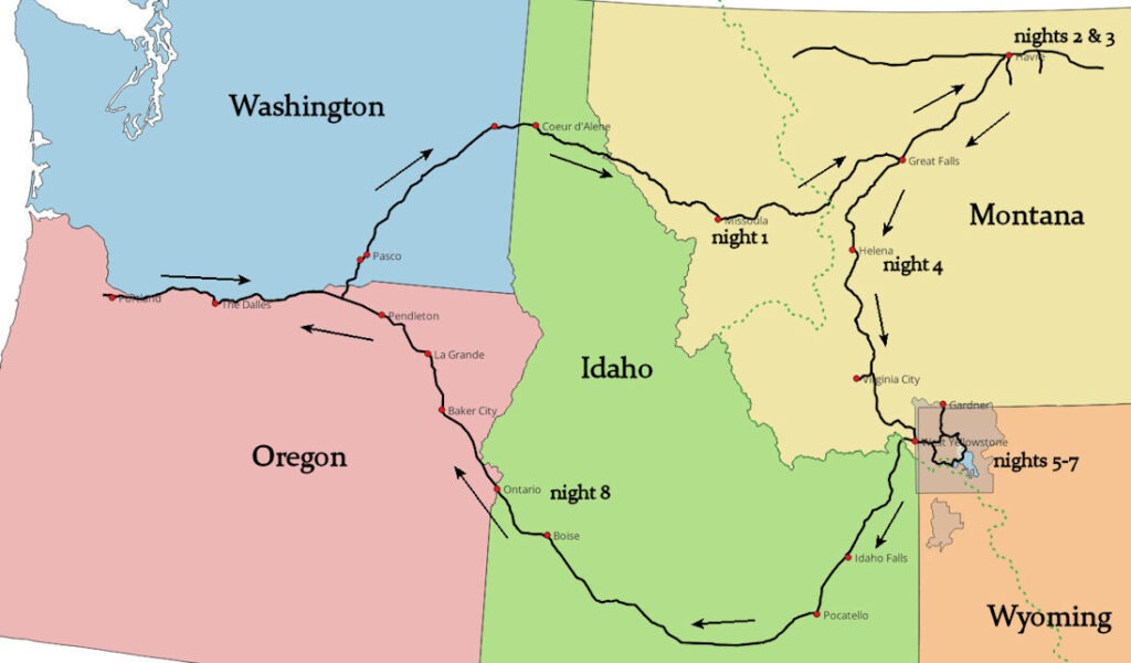
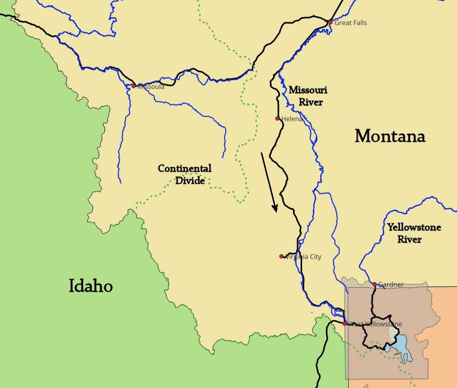
This travelogue covers driving to Havre, Montana, where a grandfather and two great-grandfathers had early twentieth-century homesteads, then down to Yellowstone National Park. A cousin suggested this trip, since he had been to neither place. His mother and my father were born in a little house on the high plains prairie north of Havre, about twenty miles from Canada. Here’s the overall trip map:
I drove from Portland, while my cousin and wife flew to Great Falls and rented a car. We knew that October could be cold and snowy. Between Missoula and Great Falls, I drove along the Blackfoot River as snow fell on a quiet Sunday morning. The serene river took no notice:
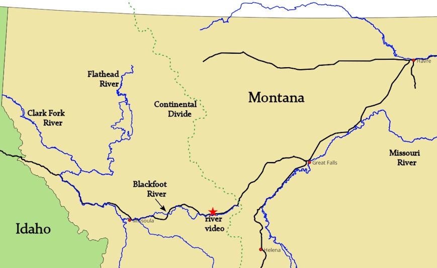
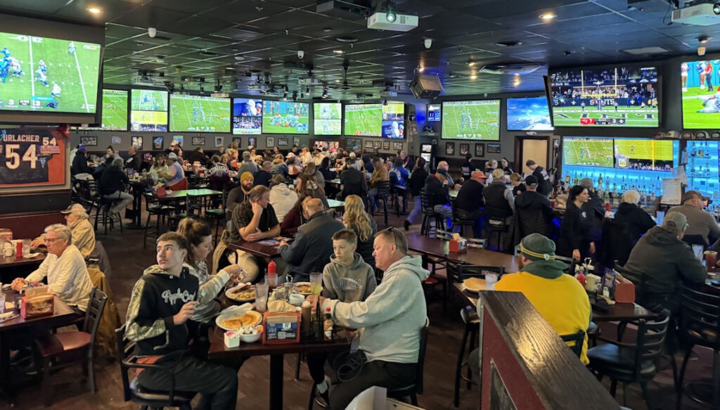
Across the Continental Divide, unimpeded by the snow, I descended into Great Falls. A local tavern provided a bathroom break and a glimpse of what some Montana folks do on Sunday mornings:
I reached Havre ahead of Phil and Paula, so I decided to visit the site of the Nez Perce’s last stand, where they fled the US Cavalry in 1877. This was the east end of a geologic oddity in the area, called The Bear Paw Mountains, only ten miles south of Havre. They are a 45-mile-wide (east-west) bump on the plains, rising to almost 7000 feet in one spot but mostly lower, rounded, treeless hills, probably averaging 4000 feet in elevation above the 2500-foot surrounding plain.
Chief Joseph had led the Nez Perce, attempting to flee the cavalry and reach Canada, where they hoped to find refuge. Today, the site of their encampment is called a battlefield. One could say calling the Bear Paws “mountains” and this site a “battlefield” are both jokes. The Indians, in early October 1877, were huddled in the draw of Snake Creek, trying to stay warm in the early-season snow. They numbered 79 men, 178 women, and 174 children. My visit was on October 12th. The Nez Perce were there on October 5th. They had snow and wind, while my visit was calm, a light dusting of snow, with air temperature in the upper 30s.
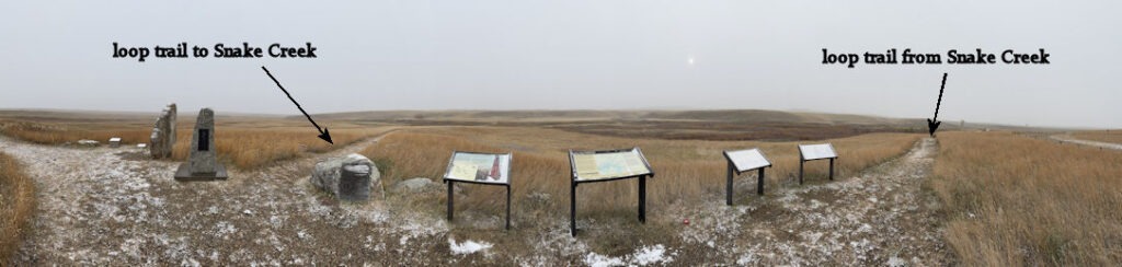
As with the site of Wounded Knee in South Dakota, this place is pitiful. The Nez Perce scouts knew the soldiers were approaching and that they were greatly outnumbered. Chief Joseph gave in as he tried to spare the women and children.
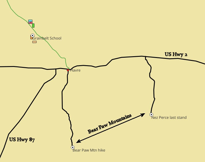
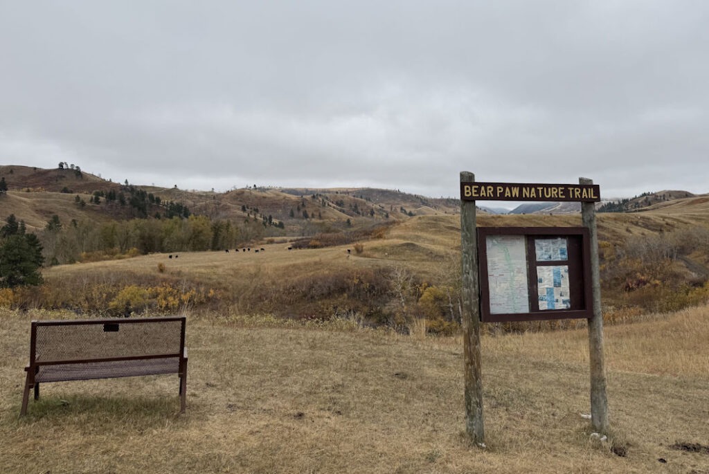
Back in Havre, I met up with Phil and Paula, and we drove out to the homesteads. But to give you another view of the Bear Paw Mountains, here’s a photo from the state park on the west side (the other end from the Nez Perce camp). We took a short hike before heading south to Yellowstone.
But first, we wanted to see the land of our ancestors north of Havre. Our grandfather had come west from Illinois as a young, unmarried adventurer. An experienced horseman, he could have been called one of the last true cowboys. For a while, he worked in the Imperial Valley of Southern California, picking up several Spanish phrases during his time as a ranch hand. In 1915, he applied for a homestead in Montana. Since this method of obtaining free land had begun in the 1860s, his options were pretty limited, prime land having been swept up long before. The acreage north of Havre could be dry and wind-swept, not to mention very cold in the winter.
Montana captured our grandfather’s heart. He died before my cousin and I were born, but we heard from our parents that the Big Sky Country had an inordinate hold on him. Indeed, he was heartbroken to have to return to Illinois during the Dust Bowl days, when this rugged land would not produce.
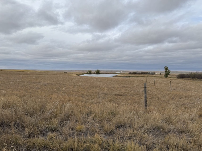
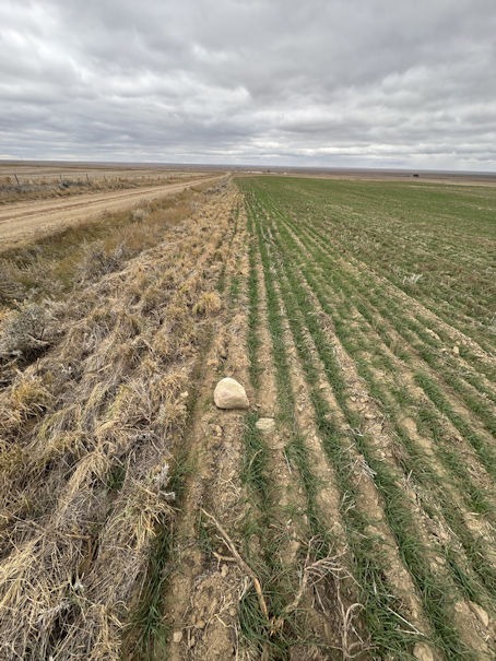
They had a small stream and pond, which is still there today. My car scared a small herd of pronghorn antelope, which ran off before I could photograph them. But if the weather cooperates, growing wheat is still viable here.
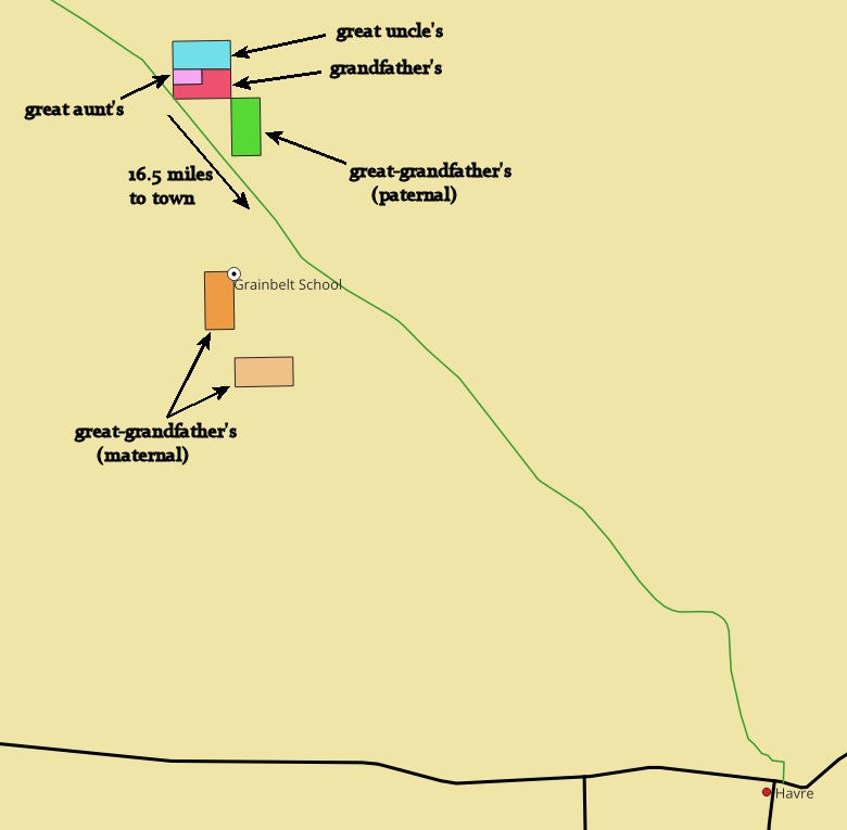
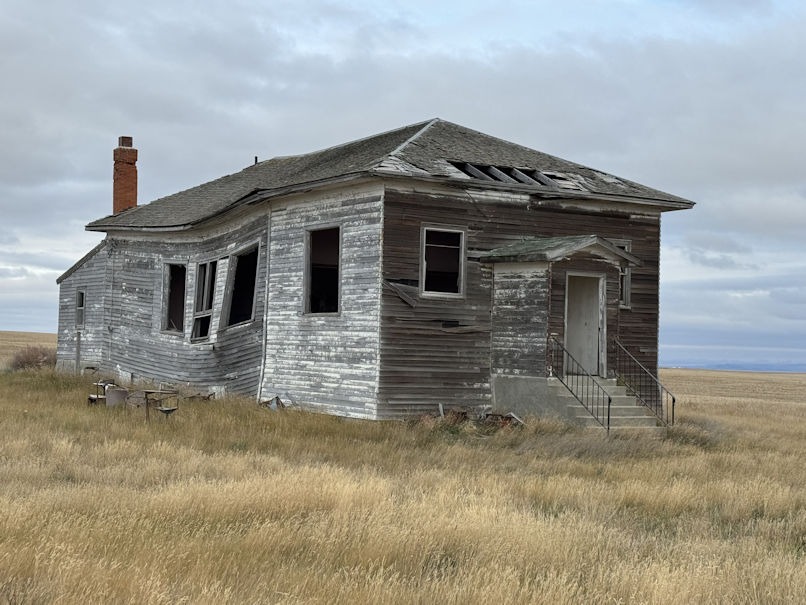
My father was the youngest of four, and Phil’s mother was the second youngest. Neither of them was old enough to attend school while they lived in Montana, but their older brother and sister attended Grainbelt School, about three miles away. Still standing in the corner of a wheat field, the place is apparently too much trouble to tear down.
The family had no car, so Uncle Howard, at ten years old, drove them to school with a horse-drawn wagon.
On to Yellowstone
The three of us spent a night in Helena, which had been snowed on the previous day. Further south, in Yellowstone National Park, when we first arrived, the temperature was well above freezing, with no snow on the ground. First, we stopped in Virginia City, the former state capital, now a ghost town of sorts.
Being mid-October, most of Virginia City was closed for the season. More interesting to me was a stop near the turn-off to Virginia City, where I got a nice view of the Madison River.
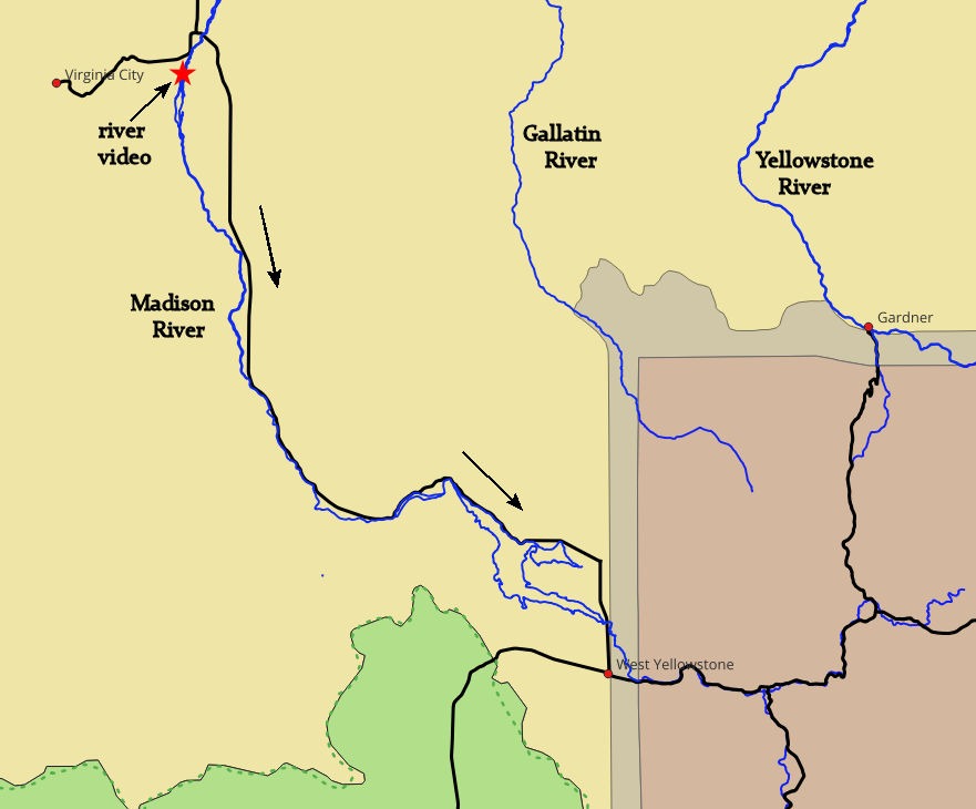
The Madison flows north out of Yellowstone National Park and, as with most Montana rivers, runs relatively wide and shallow through gravel and cobble. Further upstream, near its crossing from Wyoming to Montana, the Madison was dammed in 1914 to form Hebgen Lake. Humans created this lake, but just downstream, another lake formed in 1959 due to a magnitude 7.5 earthquake that triggered landslides and completely blocked the Madison River. That naturally dammed lake remains and is called Earthquake Lake.
We entered Yellowstone at the west entrance and, due to the government shutdown, found no one manning the entry point or collecting fees. As shown below, we bypassed the road to Old Faithful and took the northern route to Grand Lodge on the Yellowstone River, where we would spend three nights.
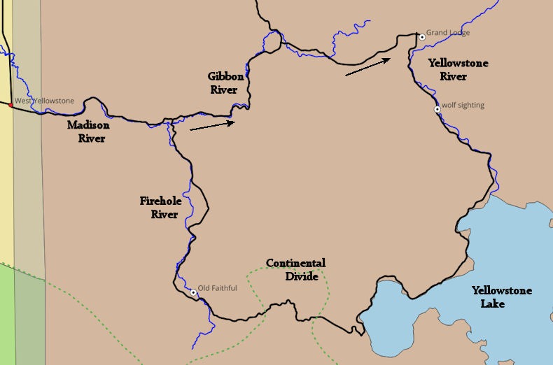
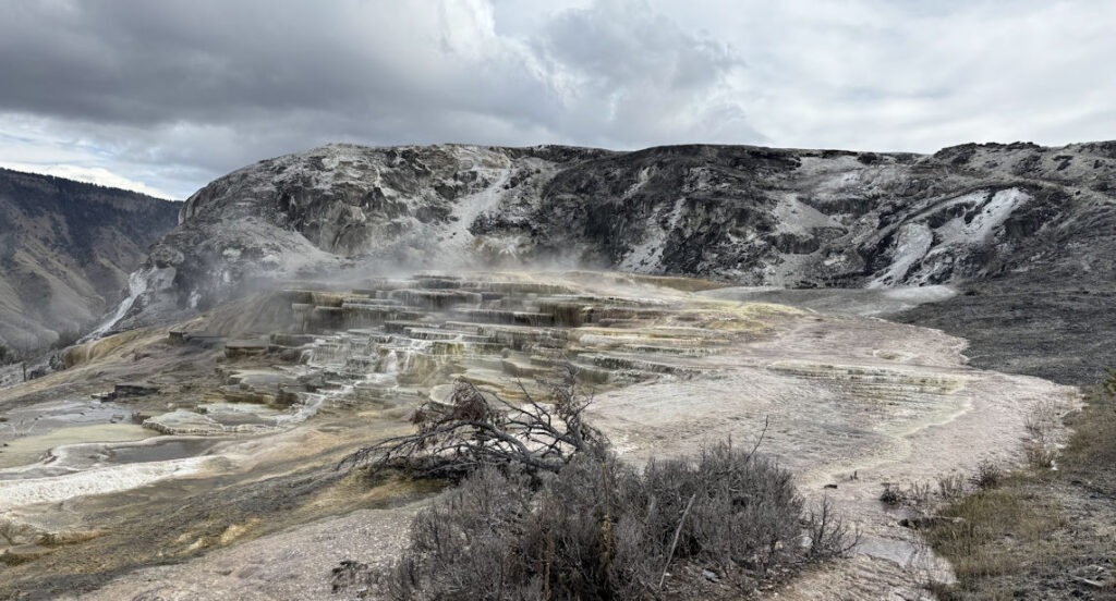
This road runs roughly parallel to the caldera’s north side. Even though Old Faithful and many volcanically active sites are further south, this area also steams and bubbles.
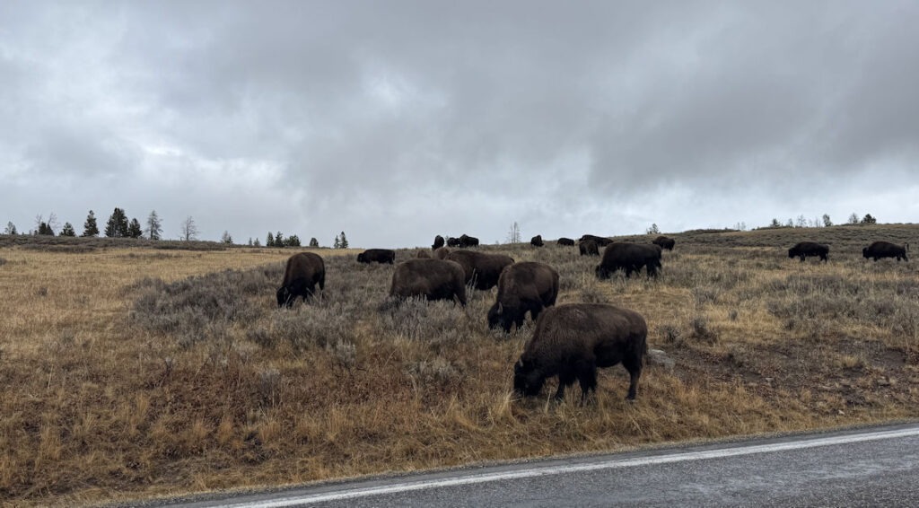
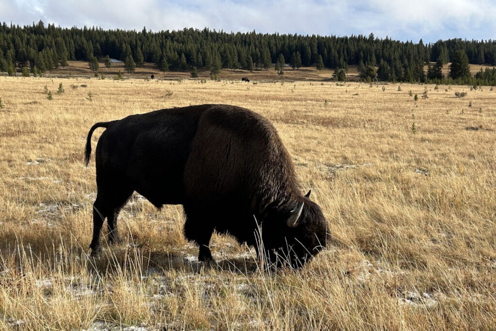
And bison graze close to the roadway:
The next day, we drove south along the Yellowstone River, past the big lake and down to the south road to Old Faithful and the activity along the Firehole River. But first, we had the sighting I most hoped for. A wolf in the middle of the shallow river was working over a carcass. It was too far away to determine exactly what it was eating, but it seemed big enough to have been an elk calf.
After a while, he decided to move on:
Crossing the road, he decided to roll in the grass, perhaps cleaning off his face of blood and guts (please excuse shakiness):
We later learned from a ranger at the Old Faithful visitor center that these are gray wolves, even though this one was black. He said that researchers have found this color variation indicates a genetic advantage and higher survival rates.
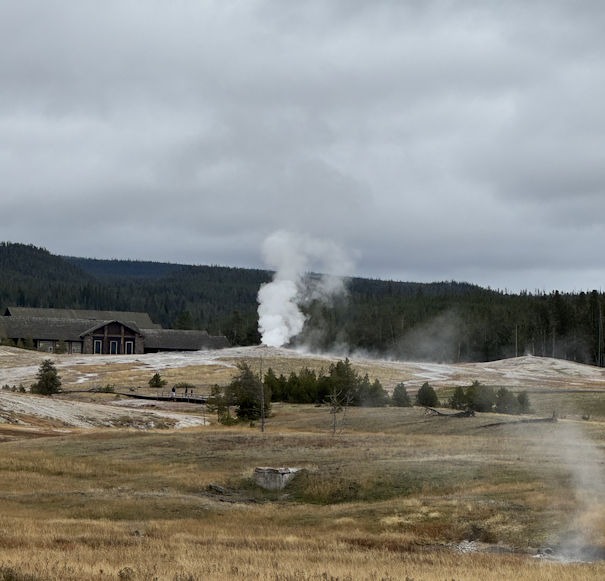
Our visit to Old Faithful came within about a week of many park roads being closed due to snow. Fewer observers watched with us as we waited for the geyser. Finally, only two minutes past the predicted time, she blew:
Later, we walked the boardwalks in the area, checking out smaller geysers and hot springs. From a distance, Old Faithful went off again:
Following the Firehole River downstream, we saw plenty of reasons why it got that name:
The next day, we hiked down to the lower falls of the Yellowstone and viewed the canyon from which the river gets its name:
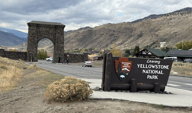
Expecting the forecasted colder, snowy weather, we decided to drive to the north entrance and have dinner in the little town of Gardner, just outside the park. We drove through the famous stone archway:
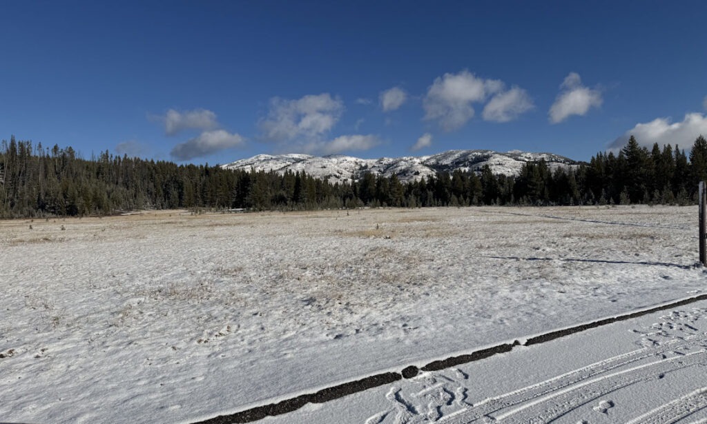
The following day, snow arrived, but we were able to safely drive out of the park. Phil and Paula drove back to Great Falls, and I headed toward Portland, taking the Southern Idaho route.
This was the day of the various “No Kings!” rallies across the country. West Yellowstone, Montana, had one in progress as we passed through town.
Yellowstone is open all year if the roads are passable. Often, they are not, and this year, especially, not much plowing would be expected, since the US government is currently shut down.
Thanks Dan. That was beautiful and a great way to picture your trip.
beautiful videos and great commentary
This reminds me of a similar trip we took many, many years ago with the boys. Great imagery and commentary. One question, regarding the City of Havre. How is that pronounced? Quarterback Brett Favre’s last name is pronounced, “Farve.” Is it the same with Havre, is it “Harve,” Montana?
Always have to ask the locals in America, right, Ken? Is the Idaho capital “Boy-zee” or “Bwoz” or “Boy-see”? They tell me it’s the latter. Anyway, Havre is “Have’-er”. I haven’t been to Havre, France, but apparently there they do not pronounce the “h” so it’s more like “ave’-reh” with the second syllable very shortened.