A trip to Arizona had two primary reasons. We are friends with the breeders of Kili and Jaro, our Basenji companions. Therese and Kevin had moved to Green Valley, south of Tucson. Secondly, a niece had married a Navajo man, and they lived on the reservation at Many Farms.
Along with Kili and Jaro, we wanted to enjoy the company of their excellent breeders, and the dogs would get to visit their father and meet many cousins. Further north, the niece and Navajo nephew had started a church to help with both spiritual and economic needs on the rez. A bonus was that we would visit the revered Canyon de Chelly National Monument.
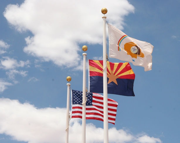
Flags at the Canyon de Chelly visitor center, with tribal flag on the right. Credit: cropped from a photo by Khlnmusa, Wikimedia Commons.
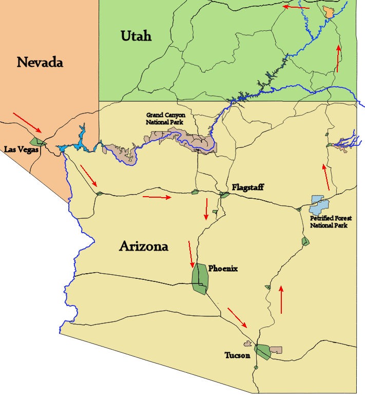
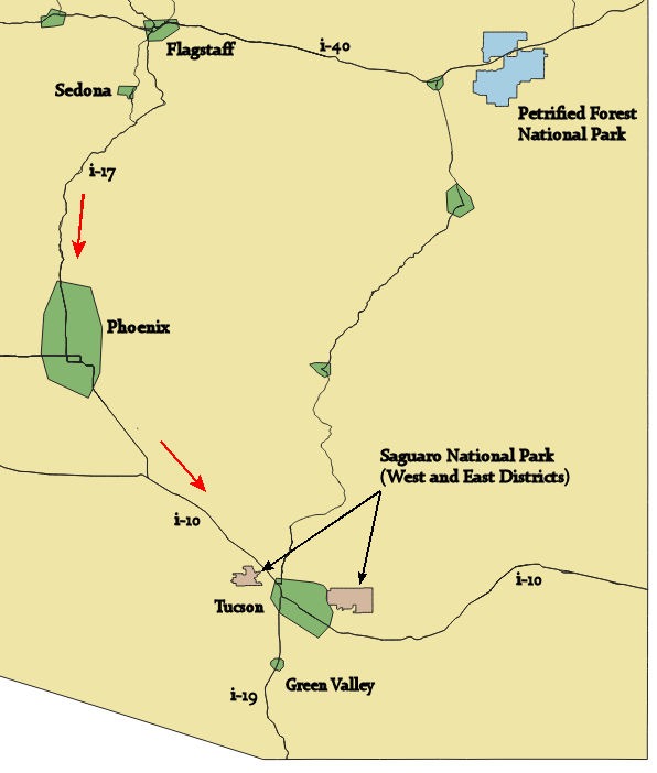
Mind in Heart readers might marvel that I could go to Arizona without stopping by the Grand Canyon. More adventures there are yet to come, but not this time. Here is a map of our route in Arizona:
Having stayed at the Williams Best Western many times, a mere 55 miles south of the Grand Canyon, we stopped in again. As the south terminus of the Grand Canyon Railroad, Williams is a fun little town with many enjoyable spots to eat and drink, perhaps while anticipating a visit to the special place to the north or else sitting around talking about your recent adventurous visit.
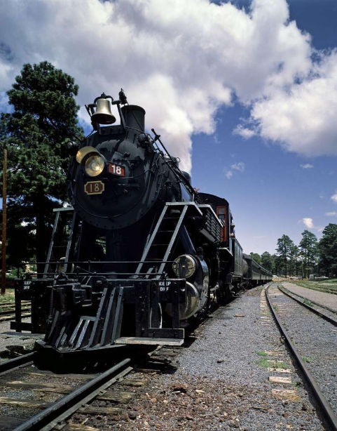
Photograph in the Carol M. Highsmith Archive, Library of Congress, Prints and Photographs Division.
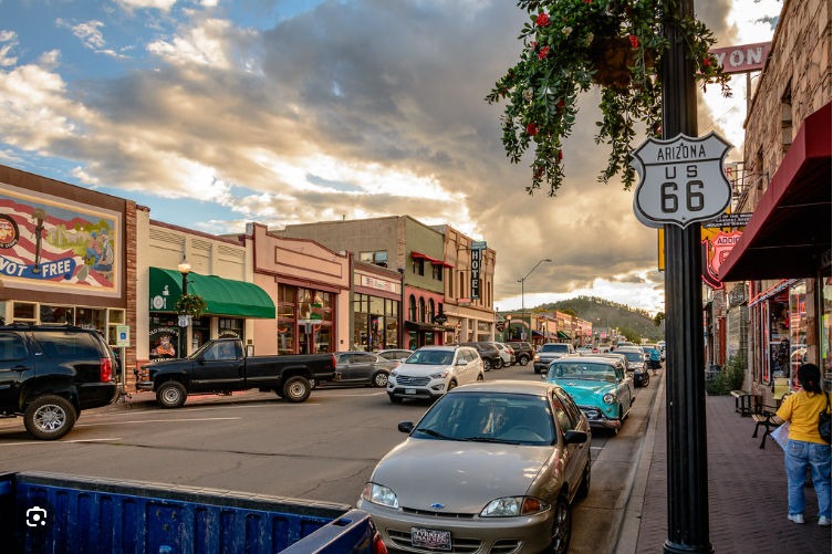
Downtown Williams. Photo by Domenico Convertini.
Interstate 40 runs east and west through Williams and Flagstaff, with the region north and between the two being the Coconino Plateau and Kaibab National Forest. With its elevation of 6770 feet, Williams is very different from desert landscapes further south. Below are photos of the scrub oak found in these higher elevations.
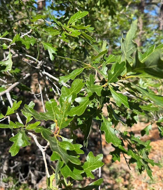
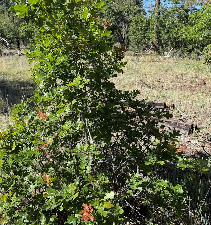
After Williams, we drove south from Flagstaff to see Sedona, the touristy town known for majestic beauty, but also for fostering new age spiritual awakenings. Visitors may wish to take advantage of Sedona’s energy vortices, supposed swirly centers of subtle “earth energy” believed to promote healing, foster meditation, and lead to spiritual growth. As I am both a professed spiritual renegade and a hydraulic engineer, I did not notice any energy eddies, nor unusual wind or water eddies.
The highway from Flagstaff follows beautiful Oak Creek, shown on the map below.
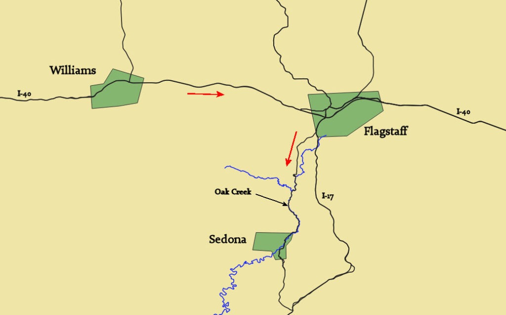
Oak Creek was worth a stop, and its flow energy was certainly toward Sedona.
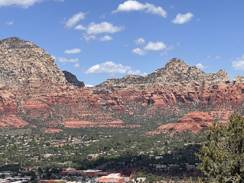
But Sedona doesn’t look like a place where too many of us common people live, as the average home price is currently over a million dollars. Maybe some more affordable outskirts exist that we missed. But to get the best view of the surroundings, we were advised to go up to the airport. (It’s on a mesa.) They must not land 747s here, but it did provide us with the following view.
Next, we headed southward into the heat, through Phoenix and down to Tucson.
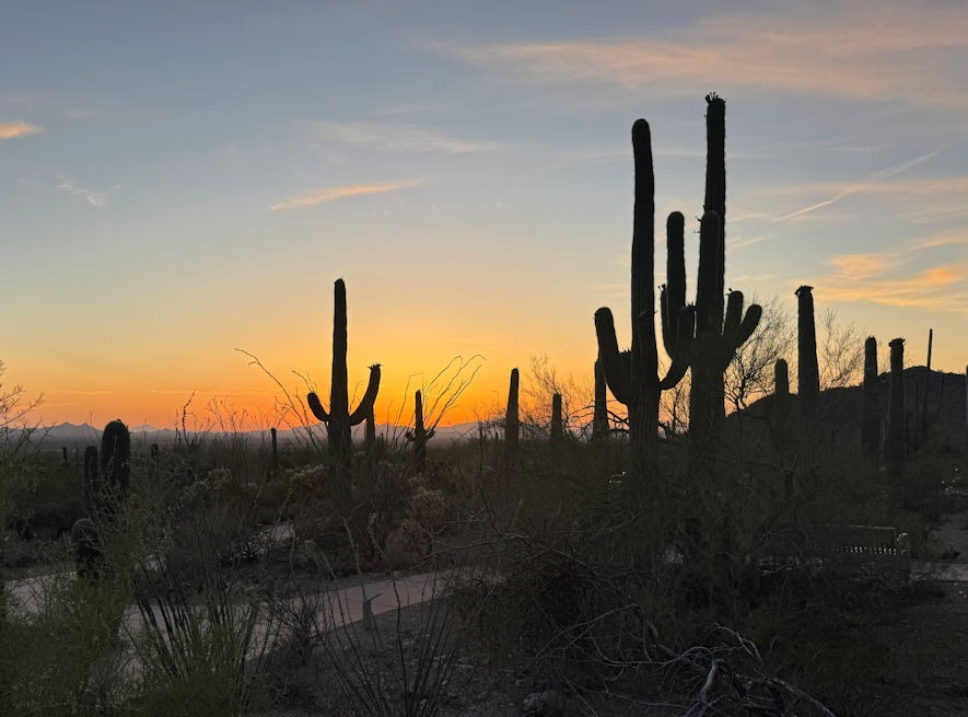
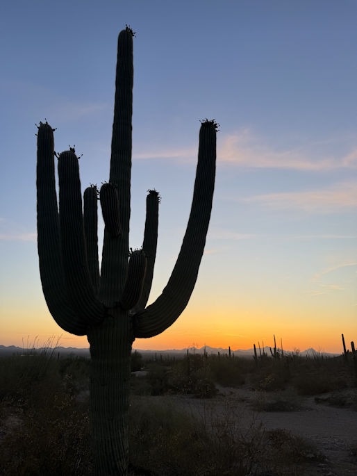
We visited Saguaro National Park, which has two units, east and west of Tucson. Visiting the west unit, we enjoyed the cactus forest in fading evening light. By the way, saguaro is pronounced suh-wah’-row.
The next day, we hiked among the desert plants. In photos I’ve seen in the past, another plant is often shown growing near the Saguaro. The spiny stems of the Ocotillo are often bare of leaves or flowers, but with moisture, they will leaf out and bloom.
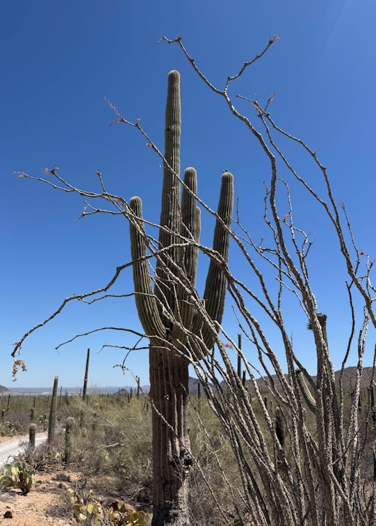
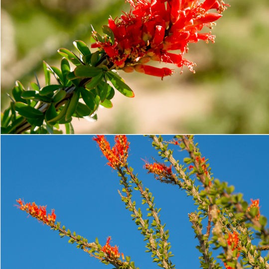
Left photo by me, with dry Ocotillo. Right photo credit: Borrego Sun, digital news about Borrego Springs, California (near the Salton Sea).
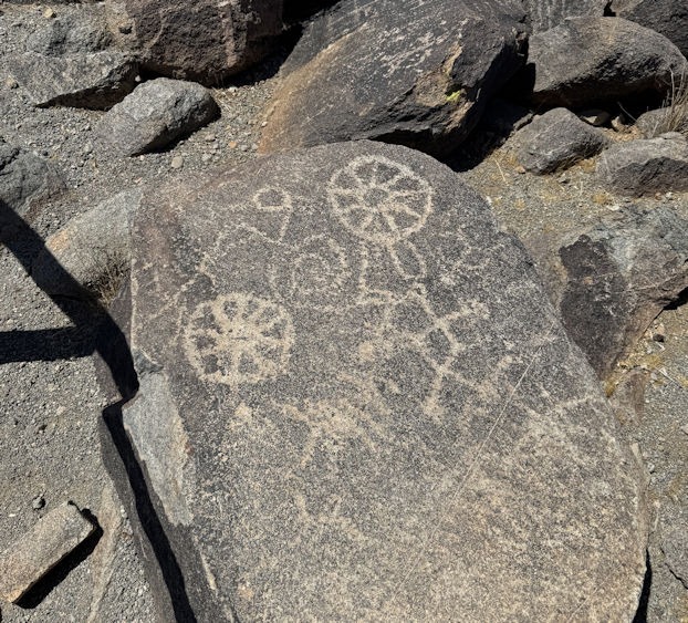
A loop hike near the visitors center brought us to petroglyphs:
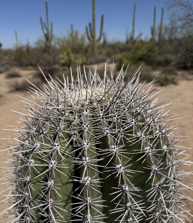
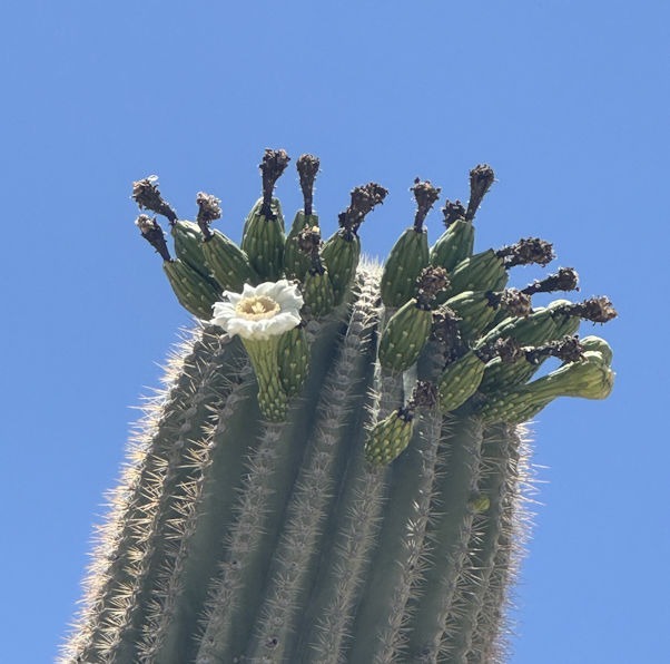
A few more saguaro photos:
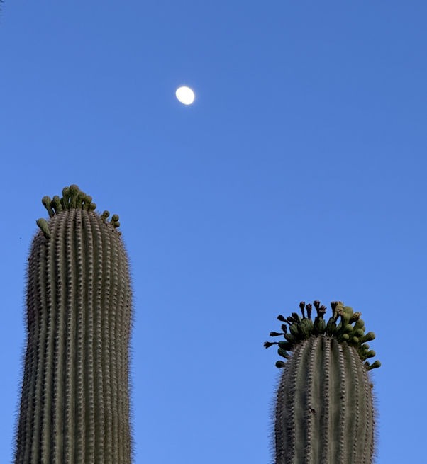
We had been informed by several sources that we should not miss the Arizona-Sonora Desert Museum, on the southern border of the national park. This botanical garden and zoo provides a great showcase of the Sonoran Desert, and it did not disappoint.
At the entrance, we were told that a docent nearby was about to lead a tour of the garden, so we decided to join the gathering. It turned out the group contained only us, and we received a personal tour from a volunteer docent who was very friendly and knowledgeable. I wish I had taken a photo of her. She is a vibrant, active, retired physician’s assistant who loves the Sonoran Desert and has learned everything there is to know about its flora and fauna.
She wore a little belted pouch from which she would now and then pull out an item for us. Some were postcards with information about the various plants. Some were even more interesting. Describing how indigenous people used to grind mesquite pods into a powder, she pulled out a vial and asked if we’d like to taste it.
With just a pinch poured onto our palms, we wetted a finger and put a little of the powder on our tongues. The mesquite powder was slightly sweet, slightly nutty. Apparently, it can be baked with, as a flour, without adding any other grain, such as wheat. However, blending with traditional flours has benefits for handling the dough, such as making it less sticky. I decided to try adding it to my sourdough.
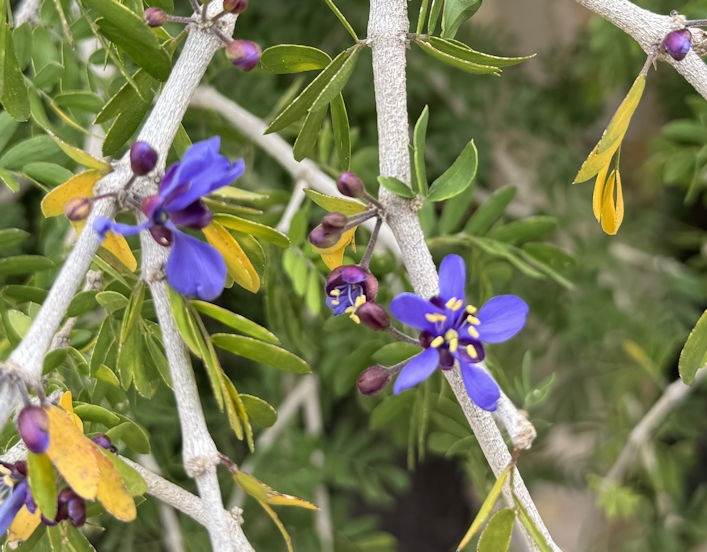
Many of the flowering plants she showed us apparently had medicinal uses for the indigenous people. Shown below is the Guaiacum Coulteri, called Arbol Santo by the Mexicans. Traditional uses include serving as an anti-inflammatory and laxative.
The Desert Museum botanical garden is also a small zoo, where various native animals can be viewed. Most interesting to us were the coyotes and peccaries, also called javelinas. A list of the mammals at the museum can be found here.
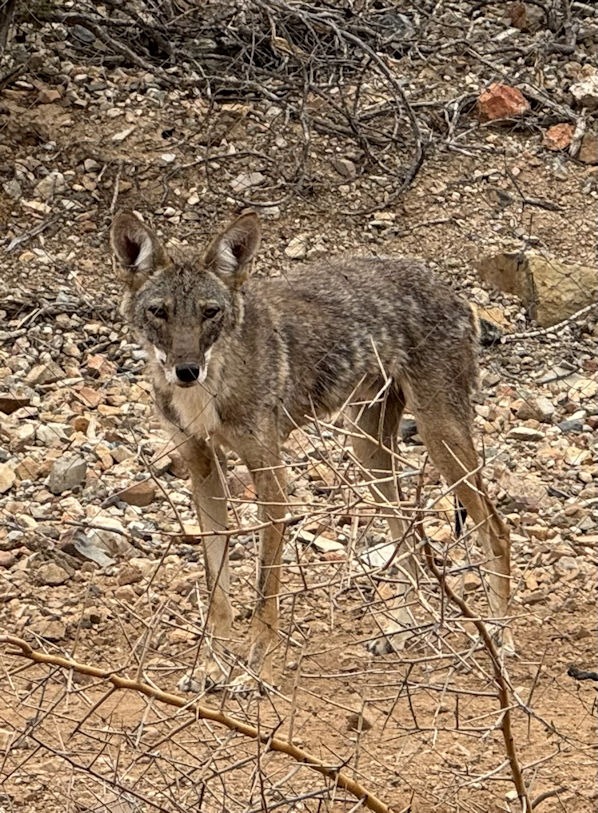
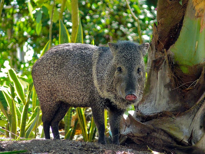
photo credit: Benard Dupont
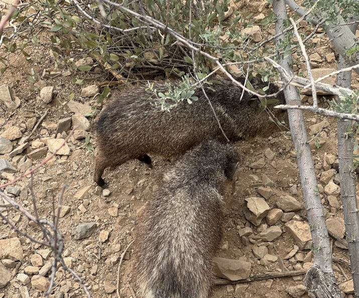
photo by me. These two javelinas were headed under our walkway through a culvert.
We headed south of Tucson to Green Valley and the home of basenji breeders Therese and Kevin. We consider them top-notch breeders, and they have a Facebook page called Fopaw’s Basenjis.
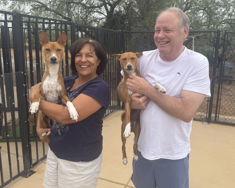
Therese, with Jaro and Kevin, with Kili, at Fopaw’s Basenjis
They keep their Basenji pack in four long kennels that connect to a small interior in the house. The length is important, as this breed likes to run, and needs exercise to stay trim and fit.
Kili and Jaro immediately felt at home and seemed to recognize Therese (we reckoned by scent, which in humans, anyway, is strongly connected to memory). They also happily greeted all their cousins and their father, Solo. Their mother had recently been sent to another owner.
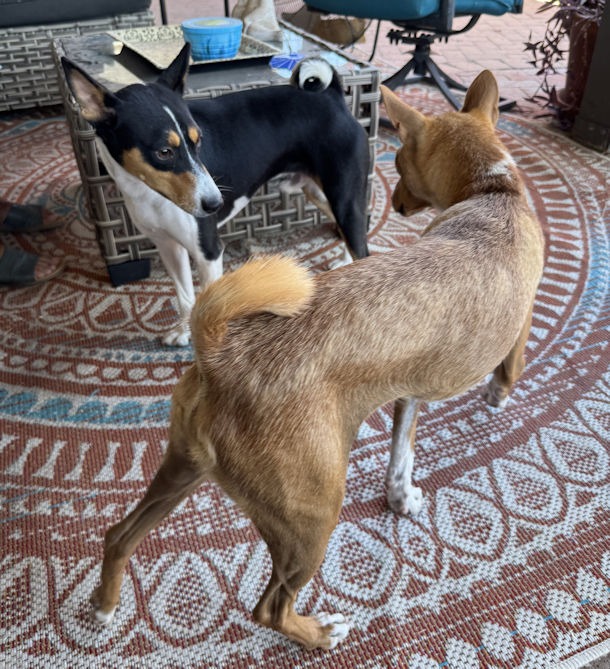
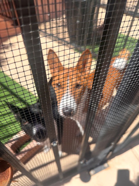
On the left, Jaro with a cousin. On the right, Solo, father of Kili and Jaro.
I asked how Therese was able to breed dogs of such a gentle temperament, as exhibited by Kili and Jaro. (Our previous basenji, Mosani, could get very angry and bite hard.) Therese said some of their temperament could correlate to their Lukuru pedigree. This is a remote jungle region of the Democratic Republic of Congo. Dr. Jo Thompson, a friend of Therese and Kevin, had been involved in traveling to this remote area to obtain basenji dogs that would help diversify the breeding stock abroad. The distant jungle location and the fact that the dogs mated in the wild without human intervention meant possibly healthier stock.
Dr. Thompson was primarily a Bonobo researcher, but was also impressed by the forest dogs. Here’s a pdf article about her effort in 2007 to bring basenjis out of the Lukuru region:
Another article about basenji DNA may be of interest. As I wrote previously, the basenji is God’s Idea of a Dog. That post has a number of links to scientific studies. Here’s a 2021 article discussing the use of the basenji genome as the foundation for all dog DNA studies, being the earliest and least tampered with dog genome.
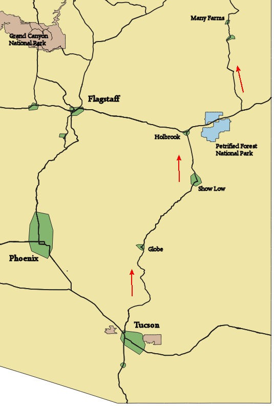
It was time to head north to the Navajo reservation. We avoided Phoenix and went through the small towns of Globe, Show Low, and Holbrook, as shown on the map below.
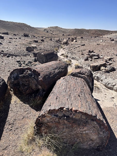
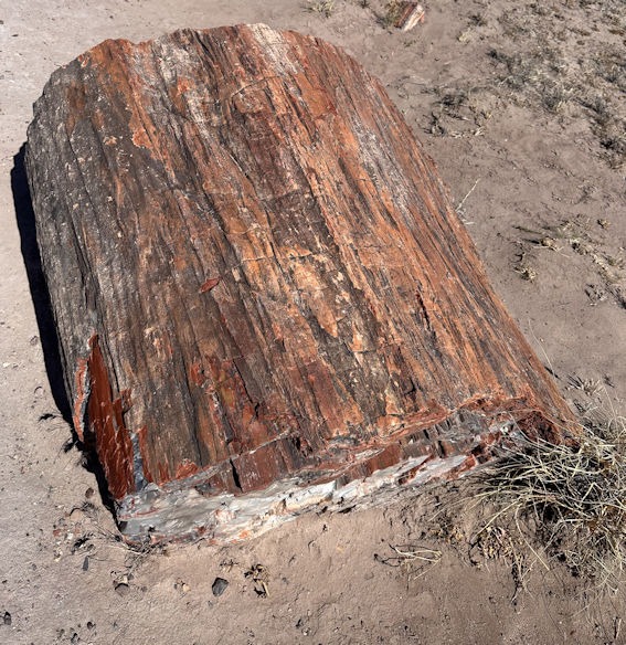
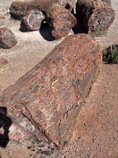
On the way, along I-40, we dropped into Petrified Forest National Park for a relatively quick drive through. The logs show that it was quite a forest. We investigated several short loop hikes through areas covered with large petrified logs, such as below.
On the reservation, Brianna and Billy have started a church and ministry to the local Navajo people. As with most reservations, the people are poor and have little means to support themselves. Many Farms is a very small community, eighteen miles north of the slightly larger community of Chinle, which lies at the downstream end of Canyon de Chelly National Monument.
The Tallas couple are quite busy, as they have two little ones and endless needs they are trying to meet on the rez. I did not manage to get a photo of Brianna and Billy together, so here are two photos, with Billy preaching a sermon and Brianna leading worship, while holding little Theo.
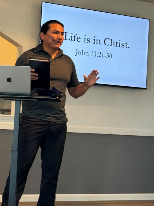
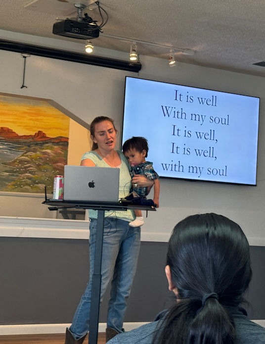
The church provides not only a community meeting place for the people to learn about Jesus, but also a source of additional food and a place to take a shower. (Many homes on the rez do not have running water.) The church has been supported by several sources, including other established churches in Arizona.
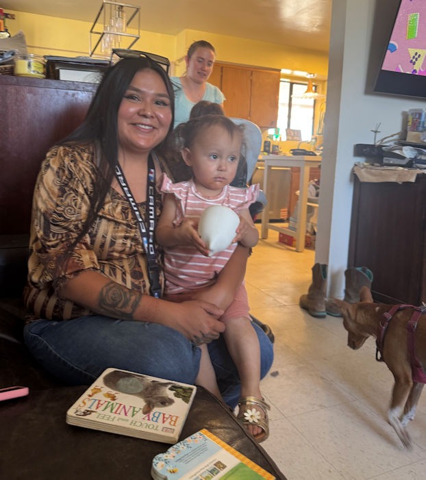
Billy has a ministry to young men on the rez, inviting them into his home (next to the church) for frequent Bible study, food, and fellowship. Below, a young woman and friend of Brianna holds her child, with Brianna in the background and Kili on the lower right, making sure any food crumbs are cleaned up.
During our stay, we were happy to be able to visit the famous Canyon de Chelly (pronounced shay). Now a national monument, the canyon has been home to the Navajo (who call themselves Diné) for several centuries. The Navajo Nation and US Interior Department work together to manage the park.
Historically, the canyon provided a microclimate from the Northeast Arizona desert, with enough shade and water supply to support indigenous agriculture. The earliest known human use of the canyon was by Anasazi natives, from about 350 to 1300 A.D. Subsequently, Hopi Indians used it sporadically until about 1700, before the canyon was occupied by the Navajo, who came from New Mexico. A Wikipedia article covers this history.
For more than one reason, visitors cannot simply drive into the canyon and look around. The place is sacred to the Navajo, so one must have a native guide. Secondly, the lower end of the canyon is filled with relatively deep sand deposits, which prevent passage by most vehicles. The Navajo guides bring visitors by jeep and must use low gears and previous knowledge of the terrain to advance.
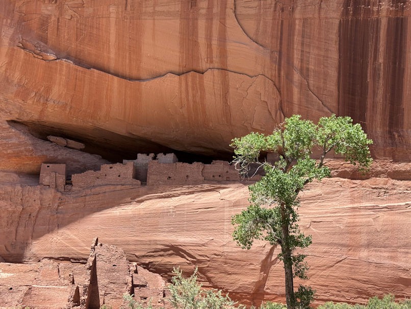
For a first look, here’s a photo of the canyon wall, with Anasazi ruins.
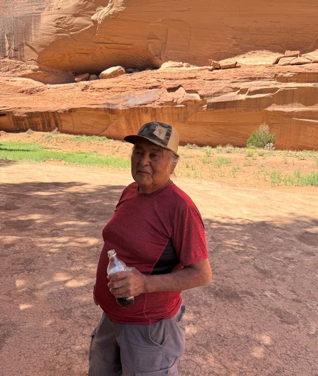
We really enjoyed Danny, our guide, who was very knowledgeable and happy to answer all our questions.
A video conveys the challenge of driving a jeep through the canyon sand:
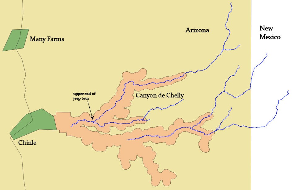
Our four-hour tour only covered a small portion of the canyon, at the downstream end:
Here are a few more photos:
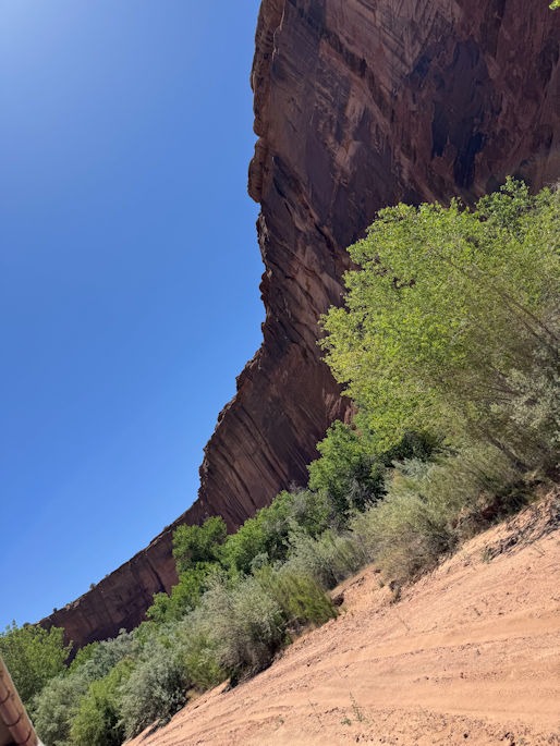
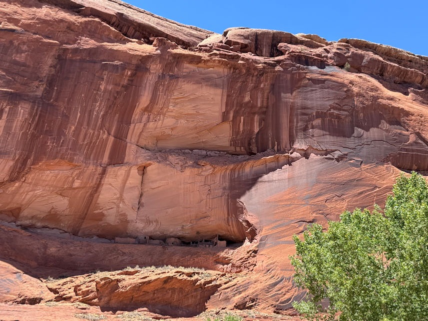
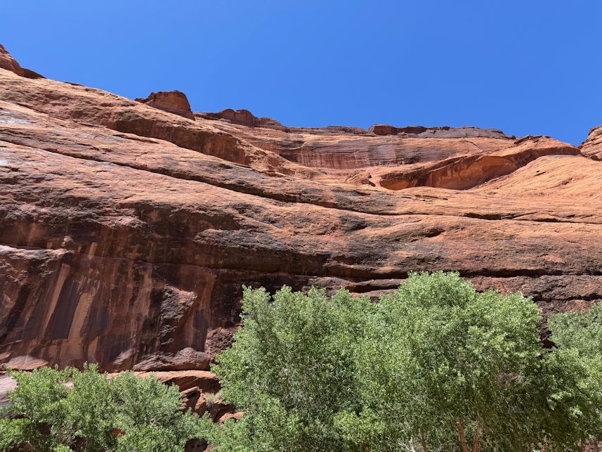
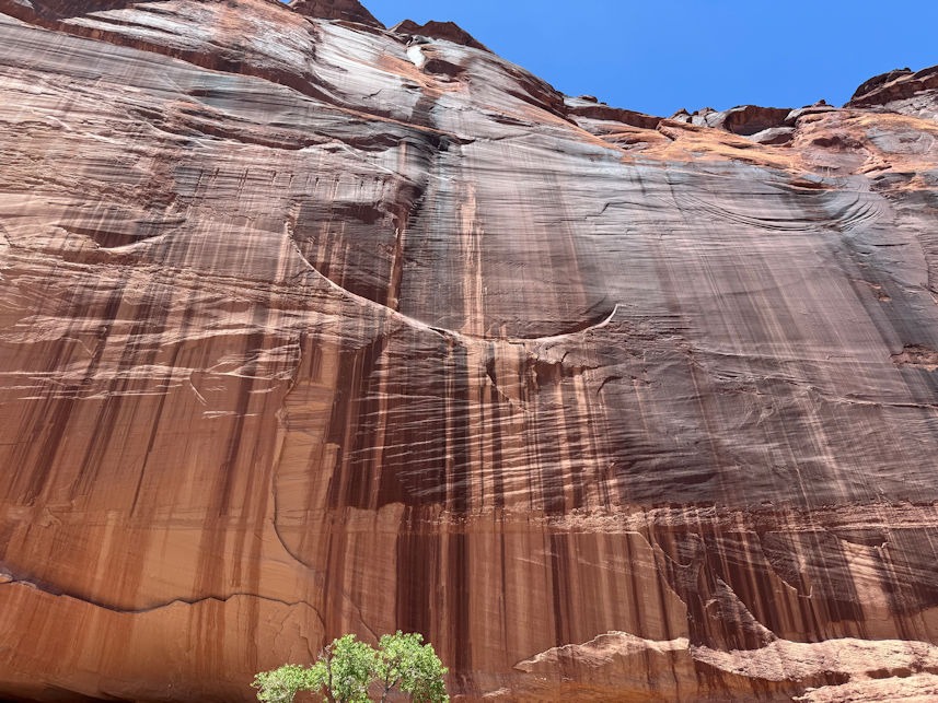
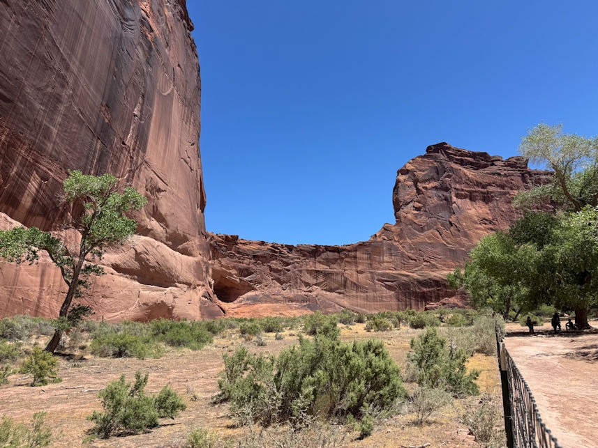
We later took a drive along the rim, from which several viewpoints provide an overview of the lower canyon.
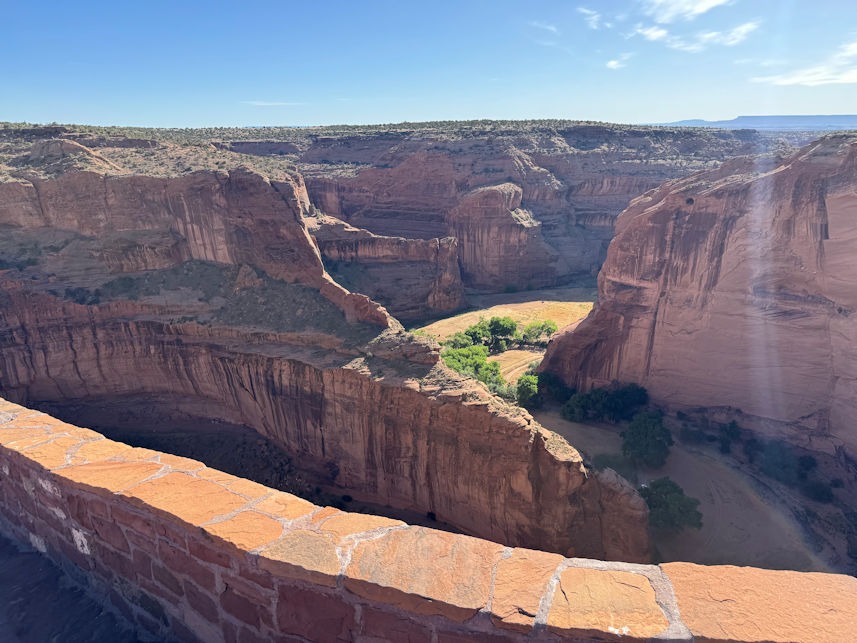
From further upstream of our jeep trip, this view looks upstream in Canyon de Chelly.
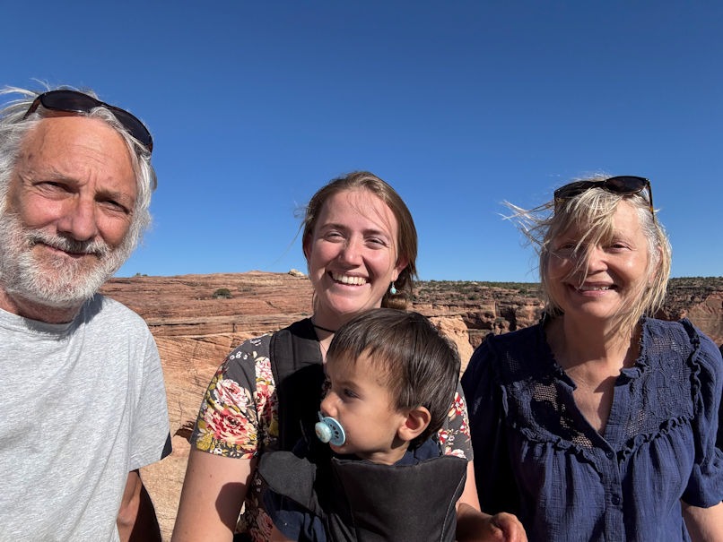
from left: nirtog, Brianna holding Theo, and Diane
Back at Billy’s and Brianna’s place, they have several cats and dogs that got along fine with Kili and Jaro. The most friendly cat has quite a personality.
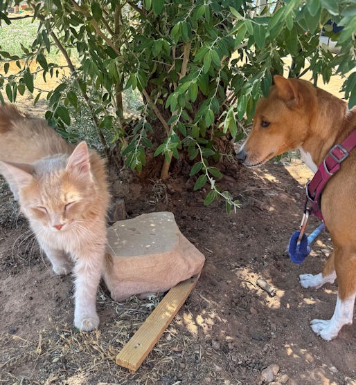
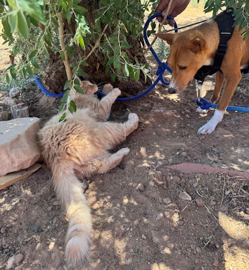
friendly rez kitty, at left, with Kili, and at right, with Jaro.
We took a trip west of Many Farms to the little community called Rough Rock to visit Billy’s mother. Billy grew up here. She does not have running water, so each week Billy and Brianna haul five gallons or so to her. She expressed thanks that she would again be able to flush her toilet.
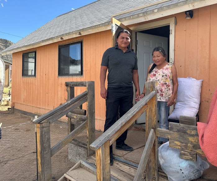
The house behind her is relatively new. Billy grew up in the trailer next door.
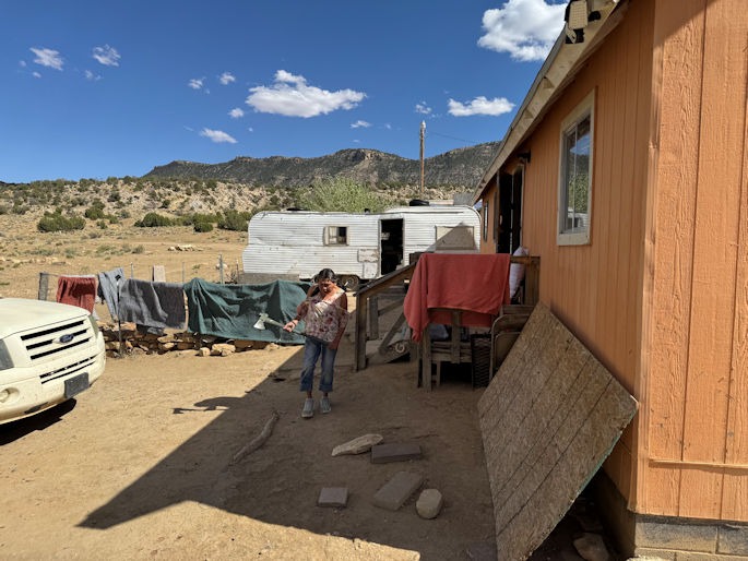
He enjoyed the wild surroundings of their place. He could roam and climb rocks; play games with his friends and brothers.
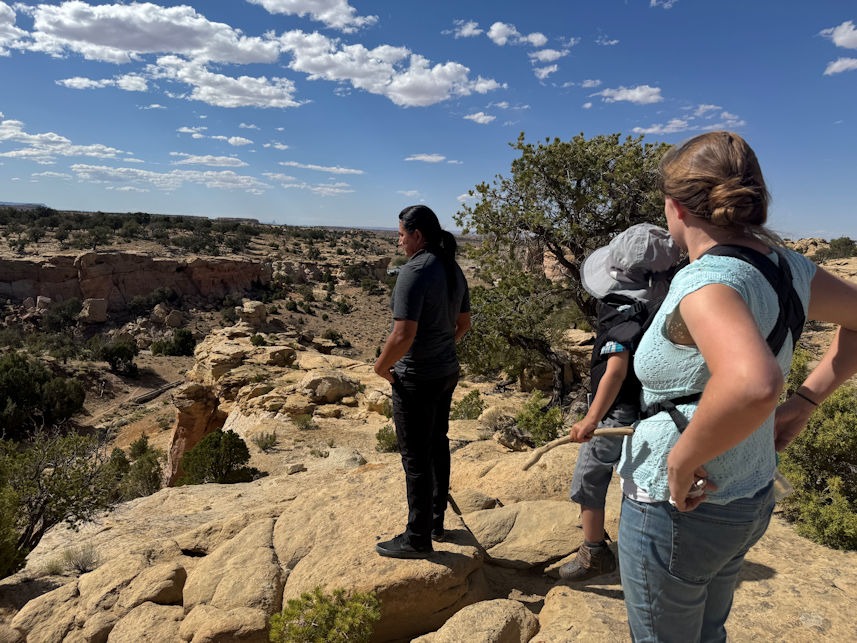
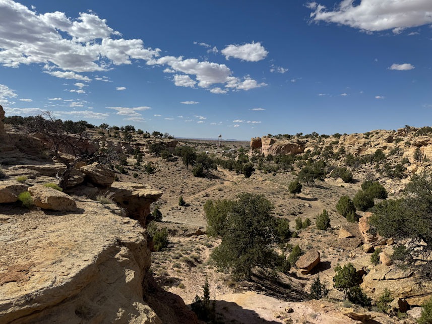
Billy’s mother and father no longer live together and have had issues with alcohol and substance abuse. However, besides Billy, they have two other very successful children. His brother, Steven, works on the rez, but has also been an award-winning film producer. On the PBS Nova series, a short film titled “Standing the Heat,” stars Steven along with Billy’s sister Nizhoni and describes how the traditional Navajo lodge or hogan (ho-gahn’) is a perfect way to stay cool during the Arizona summer heat. Go have a look at the short film!
I have been curious about how Billy came to be a Jesus-follower, and he has agreed to let me do a bio sketch of him for a future Mind in Heart post. I know this will take some time, for we will need to sit down and talk. Billy doesn’t have much time to sit around! But I will probably go visit them again and we’ll see how it goes.
We left the Navajo Reservation and headed north into Utah. On the map below, we were headed first to a motel in Monticello, Utah, then on to Arches National Park.
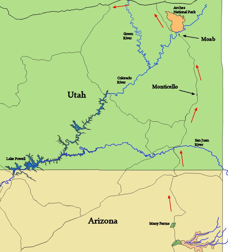
The evening darkened as we drove north along the remote forested US Highway 191. About twenty miles before Monticello, two deer jumped out in front of us. The right roadway edge was a concrete barrier, with no shoulder. One deer was clipped by our right front fender and slammed along the right side of the car. Yet, at first, we thought the damage was minimal. Sadly, the deer was probably killed, but we had nowhere to stop and the car was perfectly drivable. We could see that the right side-view mirror was knocked ajar. Only when we got out at Monticello did we discover that both doors on the right side would not open. The deer’s body had slammed hard enough to make a large impression.
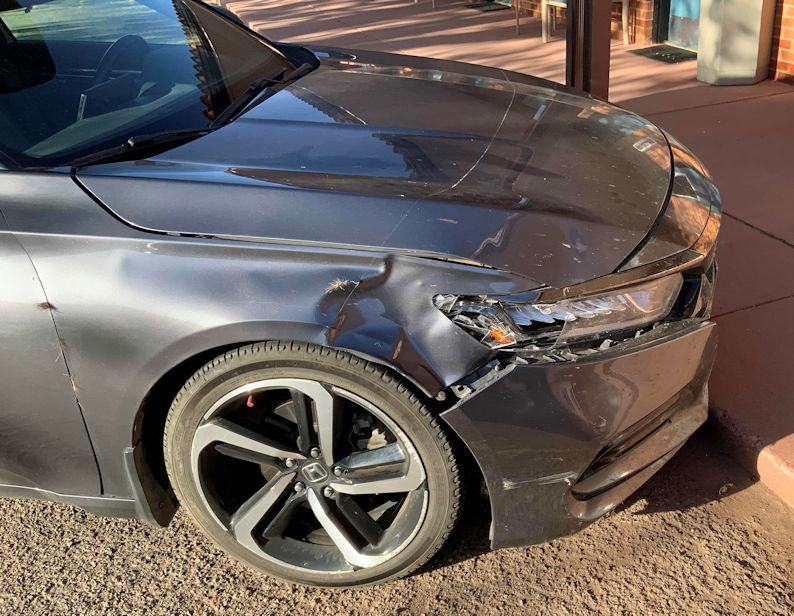

ouch
We were really sad for the deer. The next morning, a local barista informed us that the area was known for too many deer, so Utah wildlife authorities were giving free hunting permits and pleading for help culling the deer population.
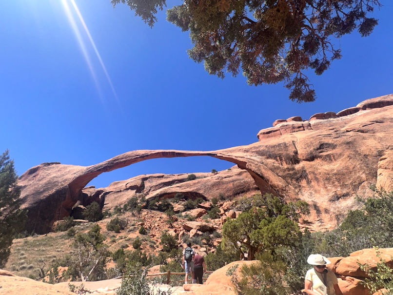
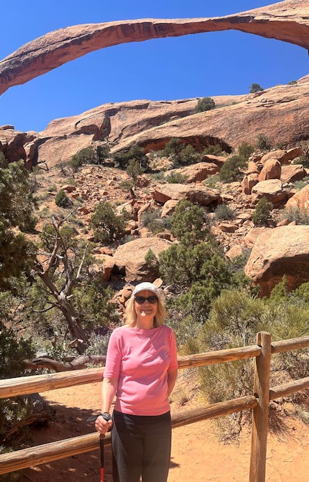
That day, we visited Arches National Park. I had been there a few times, so I watched the dogs (not allowed on the trails) while Diane hiked to Landscape Arch.
We headed home, having to crawl from the passenger side over the stick shift to get out. The fix was, well… pretty spendy. Good thing we have insurance, and I’m glad it wasn’t totaled. I like my car. It was a fun trip all around. Too bad I couldn’t fit in another Grand Canyon visit!